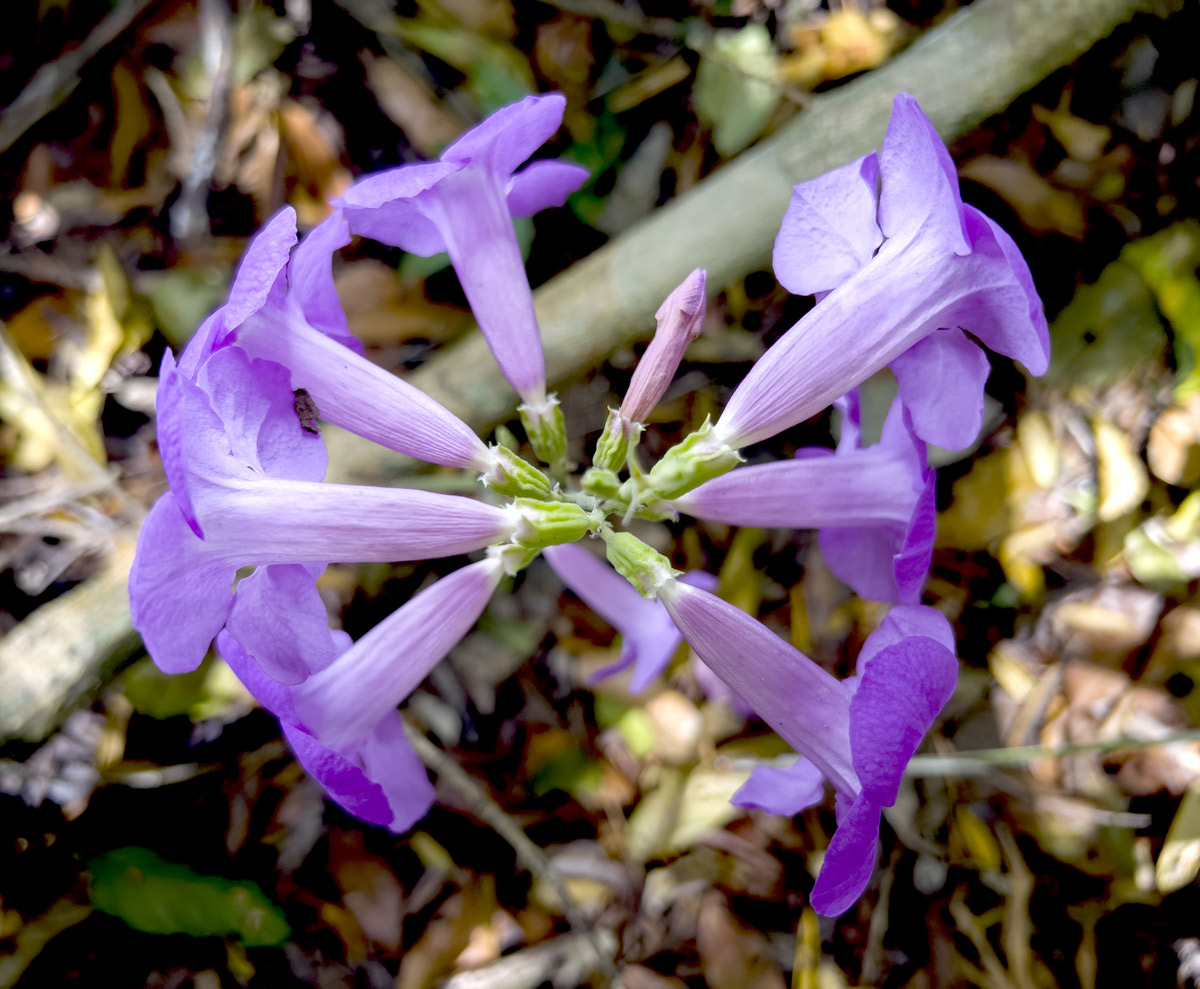
In early May we found a tower of flowers growing out of the side of a liana (woody vine) that had fallen to the ground in some earlier wind storm. So we all stopped to take lots of photographs. Here are a few samples. This is a large liana, a thick woody vine. It climbs high into the tree tops so you rarely even see any leaves. To find this liana on the ground with a spire of flowers in full bloom was unexpected.
Every botanist has a different classification; most call it Bignonia binata. But I estimate it is potentially Bignonia noterophila Mart. ex DC.
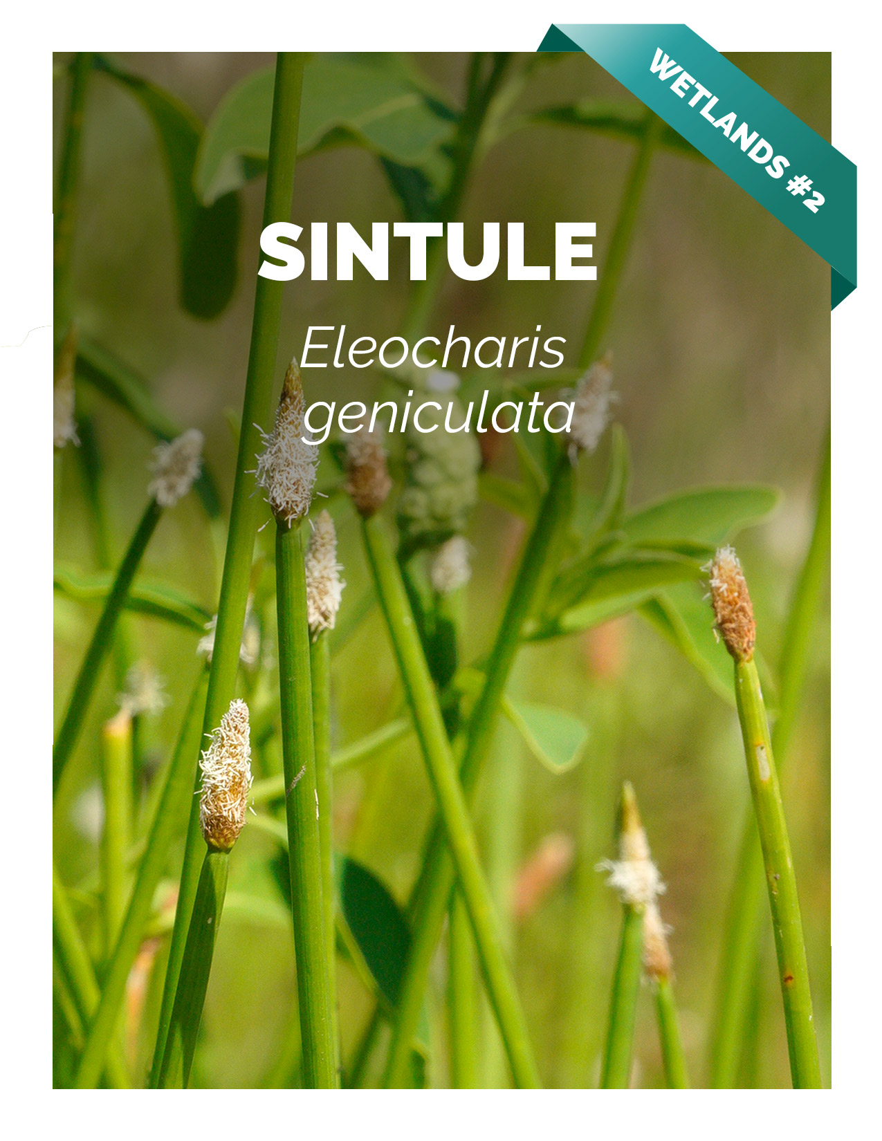
Photograph by Nicholas Hellmuth, iPhone 13 Pro Max, May 7, 2022.
Everyone suggests it is Bignonia binata. But Kew says that species is: Amazonia, Caribbean, Orinoquia, Pacific. Elevation range: 0–540 m a.s.l. Native to Colombia. Colombian departments: Amazonas, Antioquia, Atlántico, Caquetá, Chocó, Meta, Nariño, Putumayo, Santander, Sucre, Valle del Cauca, Vaupés, Vichada. (https://powo.science.kew.org/taxon/108602-1).
So has the FLAAR Mesoamerica team found and photographed and published a plant not yet documented for Peten? Need to check all the herbaria of Guatemala which are not yet on-line.
Then we found more of these lianas flowering high in the treetops of the far southeast part of Parque Nacional Laguna del Tigre (PNLT). So we are preparing two reports (one on the liana flowers in central Peten; the other report on the liana flowers in PNLT). In these FLAAR botanical reports later this summer we will cite each different botanist as to whether they use the name Bignonia binate or Bignonia noterophila.
Updated June 14, 2022 Previously Posted May 19, 2022
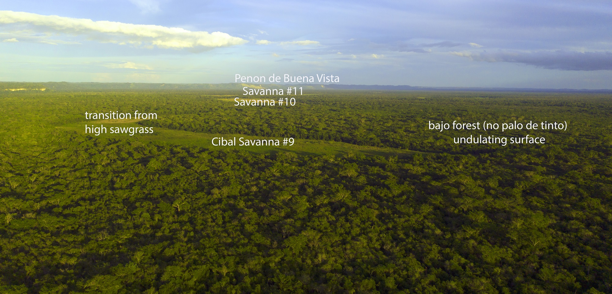
We are preparing about seven videos on different biodiverse aspects of habitats within PNLT Savanna #10. The second video is on the several unexpected and unexplained circular areas within this savanna. What causes the difference in color of the soil in these circular areas? Why do different plants grow inside the area and other plants grow outside? Did the Classic Maya modify the surface of this savanna over a thousand years ago? There is no milpa agriculture or any modern agricultural use of this savanna presently because it is inside Parque Nacional Laguna del Tigre (PNLT).
A subsequent video (later this month) will show all the rectangular areas in several areas of the same Savanna #10.
Shows the corridor between the east end of Savanna #10 and the nearby west end of Savanna #11.
View of several round areas with soil color or vegetation totally different than surrounding part of the Savanna #10.
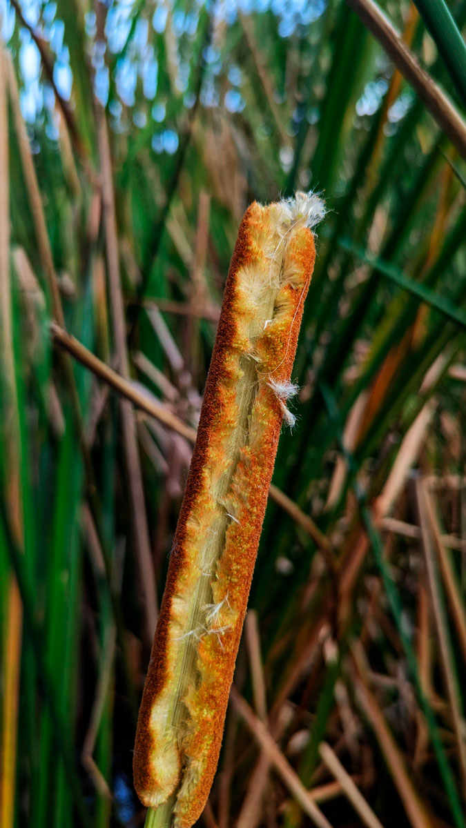
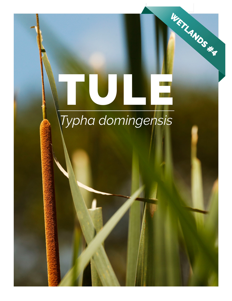
Photo by Roxana Leal, April 8th 2022. Cañón de Río Dulce. (Typha domingensis)
Searching in the internet we were able to see videos of how Typha, when ripe, takes out something similar to cotton and flies through the air. We wanted to see it with our own eyes at some point.
When leaving one of the rivers where we documented Grias cauliflora, we could observe Typha and there was just one of these plants already mature. Dr. Nicholas decided to investigate and when he opened it his "cotton" began to come out and fly through the air. It was very nice to see this!
Typha domingensis is classified as an emergent rooted aquatic microphyte, since it is rooted at the bottom of water bodies and its stem blades and inflorescence emerge from the water. This plant reproduces by its rhizome and the propagation of its flying seeds. It inhabits fresh and brackish inland waters.
Typha spp. it has a high economic potential since fiber is extracted from this plant for the manufacture of fabrics. It also has a high ecological importance, due to the fact that, in some bodies of water, this plant is introduced to control the excess of nutrients that can accelerate eutrophication processes. But, the introduction of this plant in bodies of water needs to be careful since its reproduction and propagation can accelerate too fast because its rhizomes and its vast seed bank in the soil (Hall, 2008).
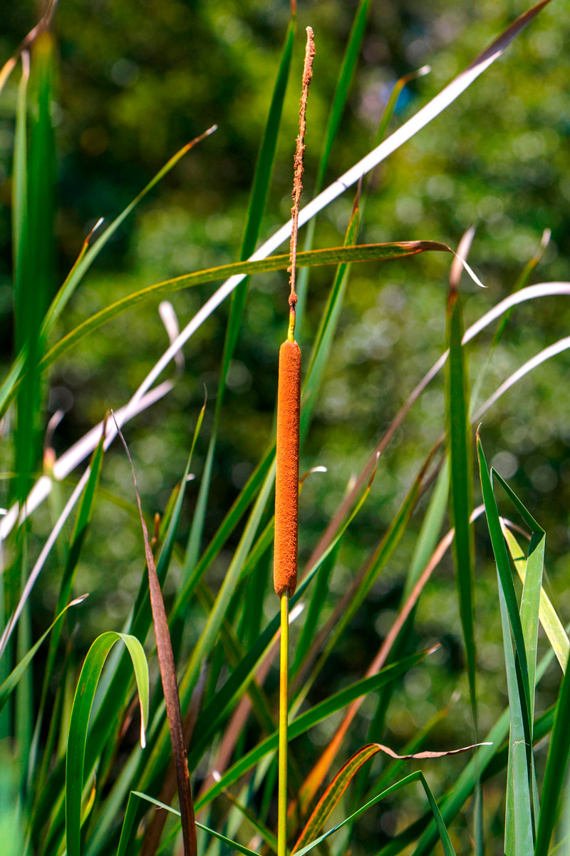
Photo by Alejandra Gutiérrez, March 2021, Cánon D1. Río Cáliz. Inflorescence of Typha domingensis.
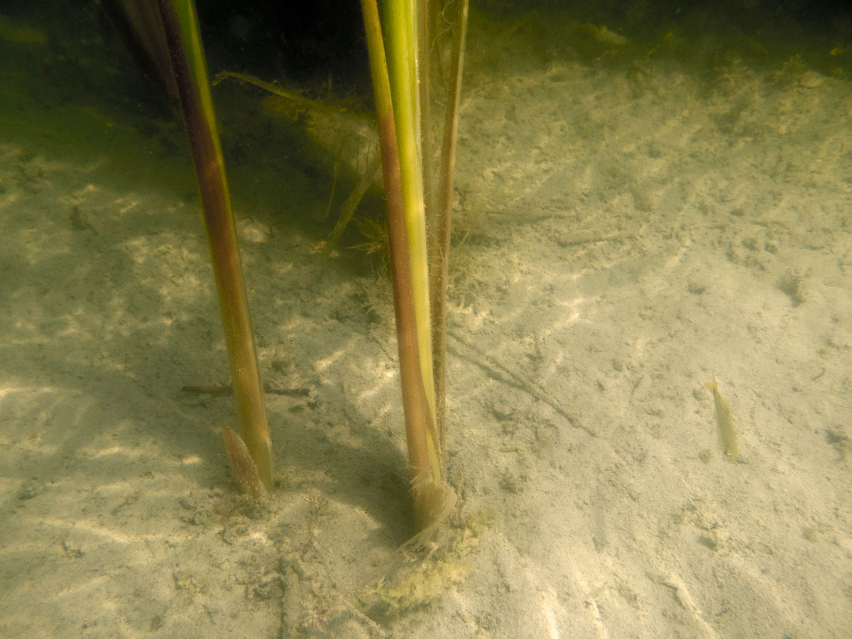
Photo by Victor Mendoza. May 2nd 2021. Sory RX100 Underwater. Lago Petén Itza, El Remate. Example of a rooted Typha domingensis.
Bibliography
Hall, S. Instituto Nelson de Estudios Ambientales, Universidad de Wisconsin-Madison, EE. UU.
Written by Lic. Roxana Leal & Ing. Victor Mendoza Bibliography by Ing. Victor Mendoza Photographs by Lic. Roxana Leal, Alejandra Gutiérrez & Ing. Victor Mendoza
During 2021 and 2022 the team of FLAAR (USA) and FLAAR Mesoamerica (Guatemala) have been focused on finding savannas from satellite images and then figuring out how to find these savannas so we could hike to each one.
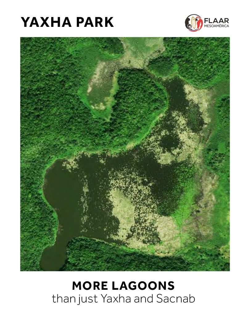
Here is an aerial photo by Haniel Lopez from the FLAAR drone DJI Mavic 2 Pro that shows how many savannas are in the southeast part of the Parque Nacional Laguna del Tigre (PNLT). We have found 35 savannas so far (and over 70 savannas a hundred kilometers to the east, outside the PNLT). Our project is 5-years of cooperation and coordination with CONAP for the entire Reserva de la Biosfera Maya (RBM), Peten, Guatemala.
Posted April 28, 2022
Written by Nicholas Hellmuth
We are pleased to share with you our invitation to deliver the results of our project: "Livingston Biodiversity Documentation" where you can learn a little more about the project and the achievements obtained by our team.
This presentation will be in Spanish starting 6 PM on Thursday, 17 March.
Very close to the Zotz camp you can find a watering hole in the southern part. The aquatic plants that prevail are the Lechuguilla de agua (Pistia stratiotis); Lentejas de agua (Lemna sp.) and (Salvinia sp.) lettuce had a very small white flower.
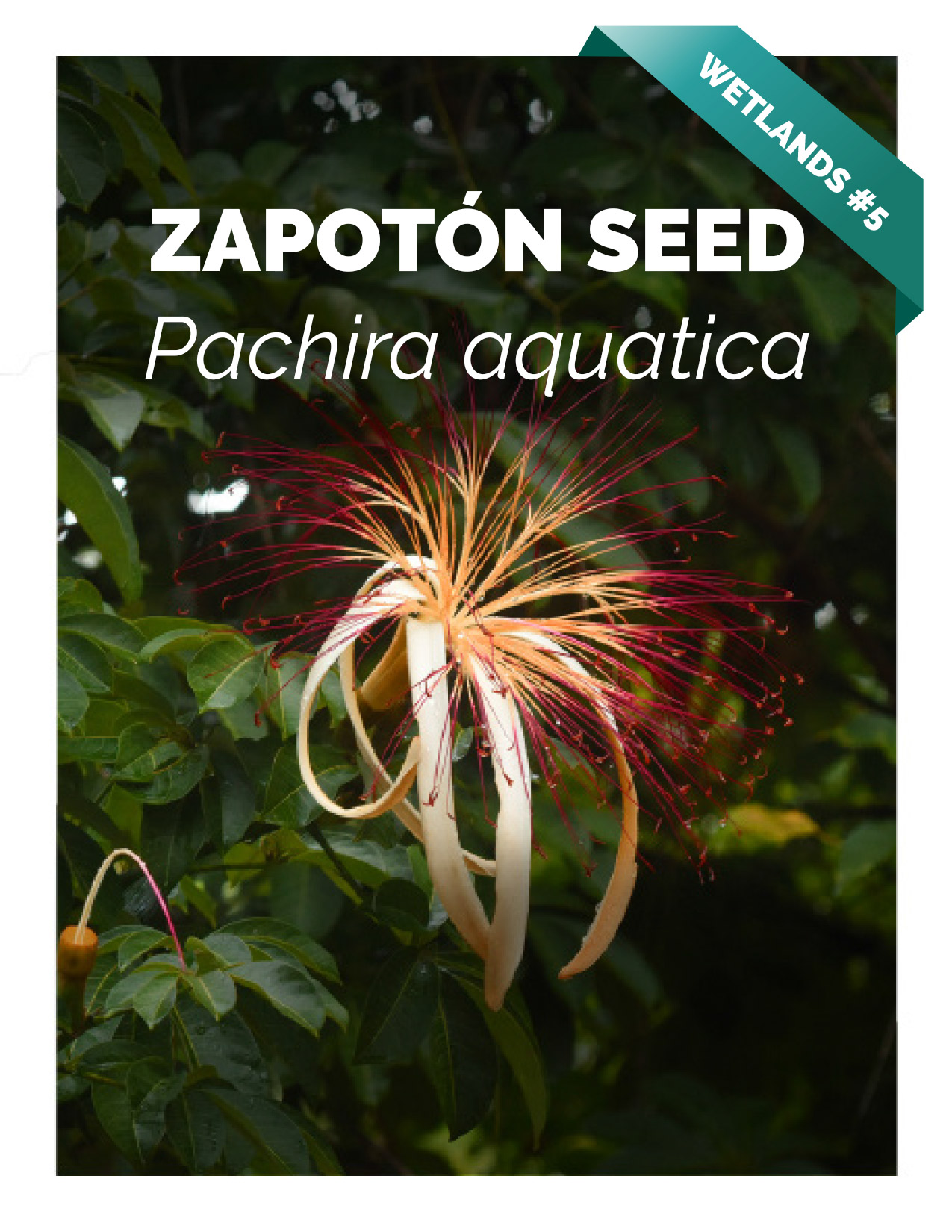
Everything together creates a very beautiful landscape. On the shore you can see a Zapotón, Pachira aquatica, which we have photographed in large numbers in the Municipality of Livingston, but you can hardly see it in Petén.
Aguada Lechuguilla – El Zotz. Drone Photo by Haniel López. February 17th
At least an hour by car from the first camp of the biotope you can reach the entrance of another of the watering holes of this site, in which if you are lucky you can see crocodiles (Crocodylus moreletii). Then you can go to the Laguna El Palmar, which is a bit complicated to observe, since there is a lot of vegetation growing around it. The team is prepared so we have a ladder which allowed us to have a better view of the place.
According to SIGAP (s.f.) “On the shore of the El Palmar lagoon the oldest occupation was found, where small human groups took advantage of the abundance of natural resources. For more than 900 years they developed their settlement, with an Astronomical Commemoration Complex and a Triadic group, both decorated with masks. In the year 100 A.D. the political headquarters moved to the top of the limestone escarpment, in search of defensive spaces.”
Written by Vivian Hurtado & Roxana Leal Identified Species by Victor Mendoza