Acrostichum danaeifolium, giant leather ferns, are in swamps and bogs of Yaxha sector of Parque Nacional Yaxha Nakum Naranjo, Peten. But are they also in the Maya Lowlands of Izabal, Rio Dulce area?
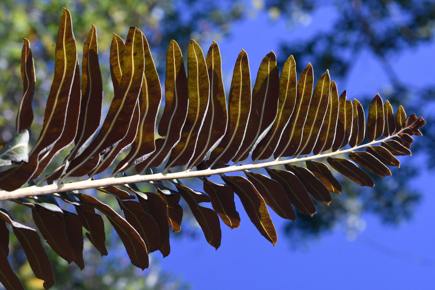
Acrostichum danaeifolium Langsd. & Fisch. is the most massive and the tallest fern I have seen anywhere in Peten. There are hundreds of them in the boggy Aguada Maya, near Poza Maya, Mayan ruins about 4 kilometers north of Yaxha ruins. So far I have not noticed “tree ferns” of genus Cyathea here (probably because of lack of humidity in the annual dry season).
Acrostichum danaeifolium Langsd. & Fisch. Aguada Maya is a Maya-made rectangular area that retains water even at the height of the dry season. Tapir love this area as do a remarkable diversity of water-related plants. This is all part of the Parque Nacional Yaxha Nakum Naranjo, Peten, co-administered by IDAEH and CONAP. Working together with the co-administrators and park rangers we did three visits to this area. Since the depth of the water is different in each part, you get different plants in each area.
This Aguada Maya is well known to Arq. Vilma Fialko, Architecto Raul Noriega and their team and known to other archaeologists who have studied Poza Maya and other sites outside the main centers of Yaxha and Nakum. Would be helpful to have a list of all plants that are inside this rectangular area compared with all the plants in the hilltops on one side and tintal and other dry ecosystems on the west.
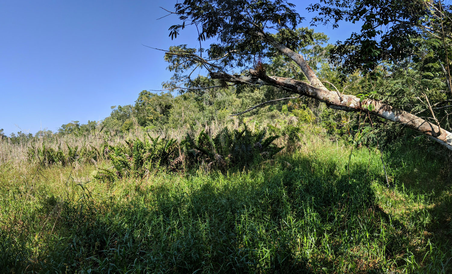
Panorama from one side of the Aguada Maya. Around the edges you can see the surrounding hillside forest. Across the middle is the stunted vegetation in the wet areas. This is not cut over; this is not an abandoned farm area; this is pristine. Acrostichum danaeifolium, the giant leather fern, is in clusters at the left.
February 17, 2019, automatic panorama with Google Pixel 3XL smart phone camera by Juan Pablo Fumagalli, FLAAR Photo Archive.
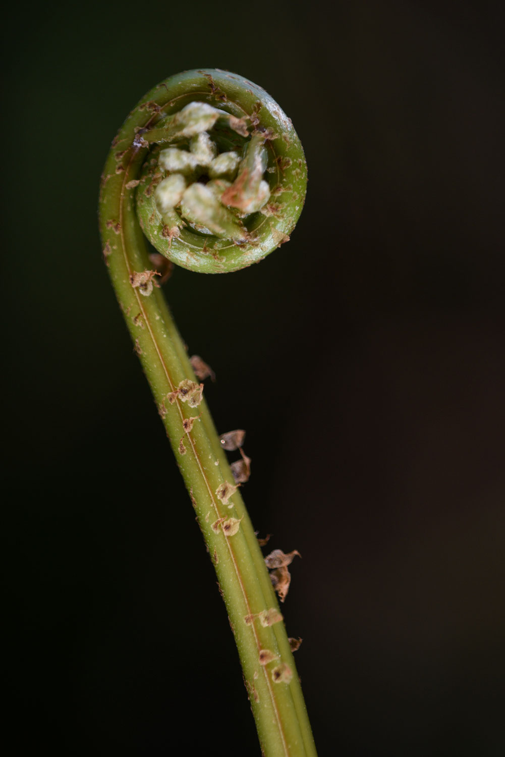
Photo by Nicholas Hellmuth using a Nikon D810, lens 200 mm. Settings: 1/250, f.4.8, ISO 400.
The Savanna of 3 Fern species is very different. It is on the top of a hill about 50 meters south of the three-segment Lagunita Perdida. None of us had ever been here before, but I had noticed the trilobal lagoons on the helpful aerial maps of IGN. The size and shape of each segment looked like a flooded cenote entrance. But we found that all this area is on top of a hill; would be informative to learn from a geologist how water gets to the top of this hill (from underground?). In a karst area anything is possible. But this area looks “filled with sediment” and since it takes several hours to hike here and then get back to the camp at Yaxha, there was not time to explore these lagoons.
So I went to the immediate south and found the “Savanna of 3 Fern Species.” I would love to rename it “Savanna of Endless Fern Species” but it was so filled with different growing organisms that I did not have a chance to find and photograph each fern species. But I found on area where the ground cover was literally covered with (low) ferns. I am used to grassland savannas, but this is the first “fern savanna” I have experienced. Plus there are ferns of one to two meters in height elsewhere in the same area. Every 50 to 80 meters the amount of water changes so the vegetation changes also. On a second visit to the southern area (with more standing water) Senaida Ba found an “aquatic” shore orchid (Habenaria repens).
Probably lots of giant terrestrial ferns in swamps, bogs, and wetlands along the sides of Rio San Pedro in Peten, and Tabasco and in Belize. But for central Peten it was an amazing botanical and ecological experience. I thank the park co-administrators Arq. Jose Leonel Ziesse (IDAEH) and Ing. Jorge Mario Vásquez (CONAP) for helping us organize the two field trips to this area with the cooperation of the helpful Guatemalan military from their camp at the entrance to the PNYNN. The park rangers helped guide us back and forth. Park biologist Lorena Lobos and park ranger Teco (Moises Daniel Perez Diaz) had the patience to hike with me about 200 meters into the savanna at the NW area of the savanna. It is so boggy you often literally sink up to your knees.
Where can Acrostichum danaeifolium be found in Izabal?
Acrostichum danaeifolium is obviously findable in the wetlands of the Río San Pedro area of Petén, such as Parque Nacional del Tigre. And surely with adequate funding and dedication to exploring wetlands of Petén, Acrostichum danaeifolium can be found elsewhere in Petén. Whether this giant massive fern is findable in wetlands around Laguna Lachoa (northern Alta Verapaz, not far from southern Petén) is worth studying. But our current goal is to find, identify, and publish as many ferns in the Municipio de Livingston as possible. First step is to go to the portal of the Neotropical Flora data base. There is one portal for ferns: www.pteridoportal.org/portal/collections/index.php. Click on the Search button (at right side of page) and when on the Search page put the Genus species of the plant you are looking for. I put in Guatemala and for State/Province put in Izabal (departamento is comparable to a provincia or an estado). I totally ignore all the other questions. I simply want to learn where in Izabal have botanists found and collected Acrostichum danaeifolium. So here are a few results from this one database:
Guatemala, Izabal, Río Perdonalis, shallow edge of river
Most specimens are listed for Jocoló and/or Rio Perdonalis. But this location is a challenge to find on Google maps (or even on Google). But wherever this is, the amount of orchids and ferns collected along this river in the last century is impressive.
After lots of searches I located Jocolo on the north side of Lake Izabal; probably still within the area of the Municipio de Livingston.
Bocas de Polochic is a logical wetlands area to find Acrostichum danaeifolium (Fundacion 2003: 16). This is in the adjacent Municipio.
It is notable that neither of these areas would have much brackish water because they are far far inland from Amatique Bay. Yet Acrostichum danaeifolium is clearly named Mangrove Fern and grows in brackish water in mangrove swamps. This raises the question of whether there is one species that thrives in brackish water and another species that likes totally fresh water of Peten. But Acrostichum aureum is not listed anywhere for Peten or Izabal in the Neotropical Flora database (only for near Pacific which is potentiall brackish water area).
Where can we find giant ferns in Municipio de Izabal?
Next step is to find and explore wetlands around the northern and southern areas of El Golfete. Lots of mangrove swamps here.
Next step is to explore all the rivers and creeks that flow into El Golfete and into Amatique Bay, and see which ones have bogs and/or swamps or other wetlands near them.
It is essential to have aerial photographs. But for an ecology project you want aerial photos, not LiDAR; you do not want to remove the vegetation (which is what LiDAR does electronically), you want to have 100% of the vegetation in the aerial photograph.
Also essential is high-resolution drone photography of each wetland, being careful not to fly near any birds. We have licensed experienced drone pilot available, so look forward to finding all the biodiverse wetland ecosystems of the Municipio de Livingston, Izabal.
Bibliography, books, articles, web sites: List of Suggested Reading on Acrostichum danaeifolium, giant leather ferns
Once we find Acrostichum danaeifolium in Izabal we will prepare and publish a comprehensive annotated bibliography. But in the meantime, here are a few titles to see where Acrostichum danaeifolium has been found or mentioned, in Peten or Izabal areas of Guatemala. Acrostichum danaeifolium is a Lowland fern, growing it wetlands. It is not a hillside fern growing in cloud forests up in the mountains.
- 2018
- Gametophyte morphology of Acrostichum aureum and A. danaeifolium (Pteridaceae). Rev. biol. trop Vol.66 No. 1
Available online:
www.scielo.sa.cr/scielo.php?script=sci_arttext&pid=S0034-77442018000100178
- 2003
- II Plan Maestro 2003-2007. Plan Maestro del Refugio de Vida Silvestre Bocas del Polochic. Fundación Defensores de la Naturaleza. Guatemala. 100 pages.
- 1975
- Reproductive Biology and Gametophyte Morphology of Acrostichum danaeifolium from Mexico. American Fern Journal. Vol. 65, No. 4, pages. 105-120.
Available online:
www.jstor.org/stable/1546343?seq=1
- 2003
- Phenological studies of Acrostichum danaeifolium (Pteridaceae, Pteridophyta) at a mangrove site on the Gulf of Mexico. Journal of Tropical Ecology Vol. 19, No. 2, pages 155 – 162
Available online:
www.researchgate.net/publication/231818192_Phenological_
studies_of_Acrostichum_danaeifolium_Pteridaceae_Pteridophyta_
at_a_mangrove_site_on_the_Gulf_of_Mexico
- 2009
- Historical biogeography of the Yucatan Peninsula, Mexico: a perspective from ferns (Monilophyta) and lycopods (Lycophyta). Biological Journal of the Linnean Society, Vol. 98, pages 775–786.
Available online:
https://academic.oup.com/biolinnean/article/98/4/775/2448148
- 2009
- Los Cuerpos de Agua de la Región Maya Tikal –Yaxhá: Importancia de la Vegetación Acuática Asociada, Calidad de Agua y Conservación. USAC, Programa Universitario de Investigación en Recursos Naturales y Ambiente. PUIRNA.
Useful websites
www.cicy.mx/sitios/flora%20digital/ficha_virtual.php?especie=20
General information
www.discoverlife.org/mp/20q?search=Acrostichum+danaeifolium&guide=Ferns
Photos and references
www.levypreserve.org/Plant-Listings/Acrostichum-danaeifolium
General information
www.naturalista.mx/taxa/130818-Acrostichum-danaeifolium
Distribution map and photos
First posted June 29, 2020
Bibliography prepared by Vivian Hurtado, FLAAR Mesoamerica