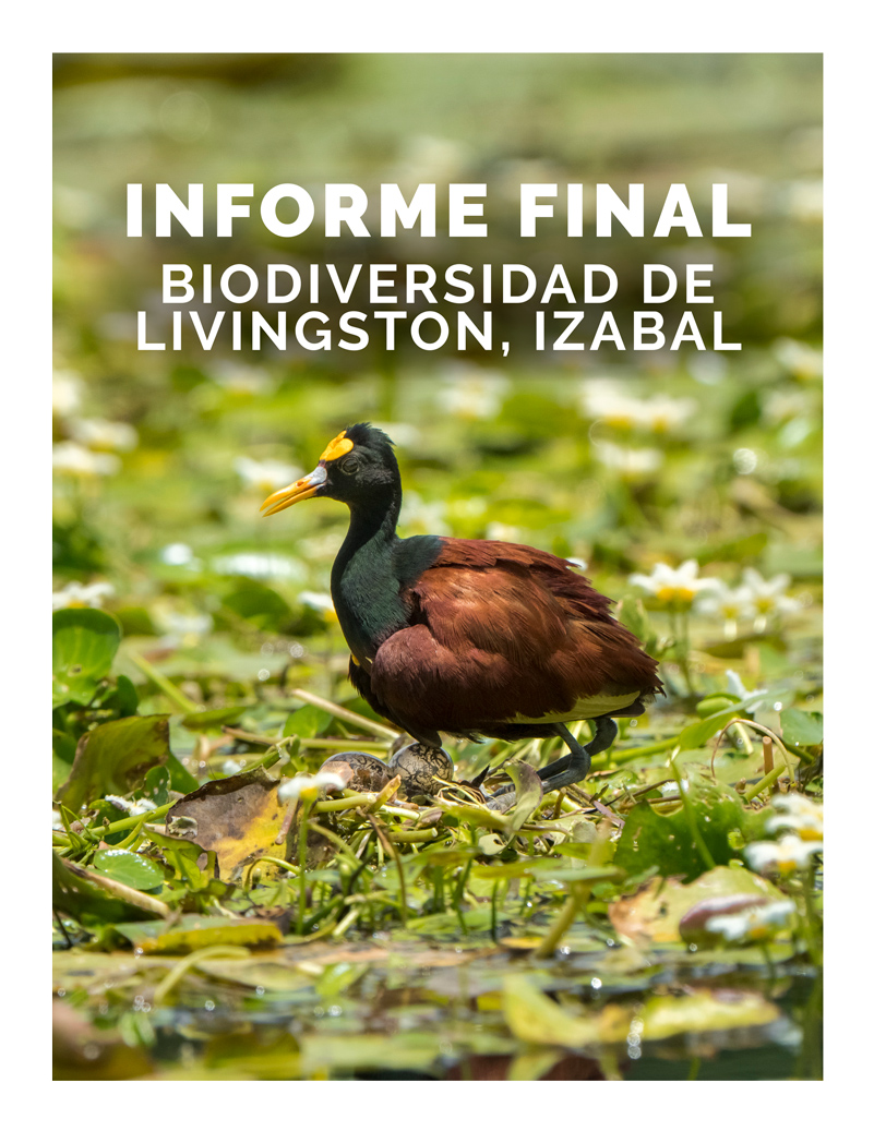
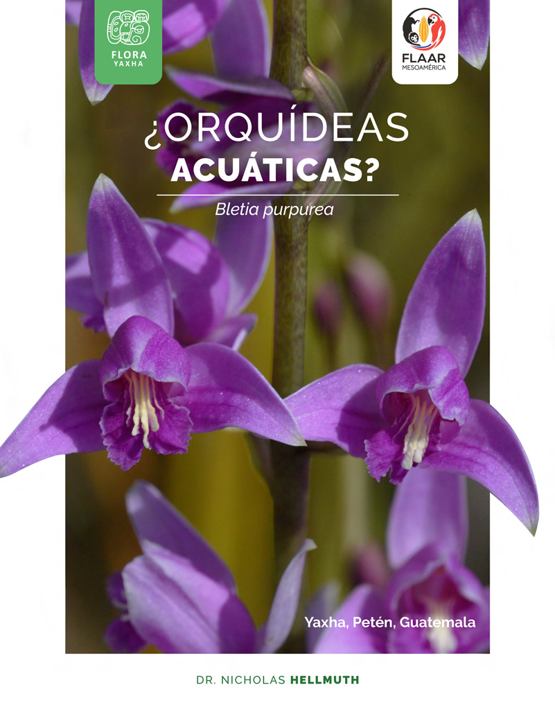
Guatemala is a living botanical garden of every habitat you can imagine from cloud forests to seasonal rain forests to the totally different dry cactus-covered hills along Rio Motagua and Rio Sacapulas. Plus the Pacific Ocean water lily lagoons of Monterrico and of Arroyo Pucté in Sayaxché. And the photogenic heliconia-filled fields of the Caribbean areas of Rio Dulce.
If you like tropical flowers, a location I recommend visiting is Parque Nacional Yaxha Nakum Naranjo. We (FLAAR Mesoamerica research teams in Guatemala) found different sizes, shapes, and floors of passionflower vines in the remarkable biodiverse ecosystems of the park. So we now have a new web page to show you samples.
Local registered guides in Peten can explain which flowers are blooming in which months (since every month is different, and every ecosystem has different flowers: savanna, riverside, lakeside, hilltop, tintal, etc.).
I have traveled to all the main popular destinations around the world, but my heart and soul are in the Peten, Alta Verapaz, and Izabal areas of Guatemala. As soon as the airports are open, I will be flying back south to explore and find more plants. We thank Passiflora botanist Dr John MacDougal for helping us identify the species of passionflower vines.
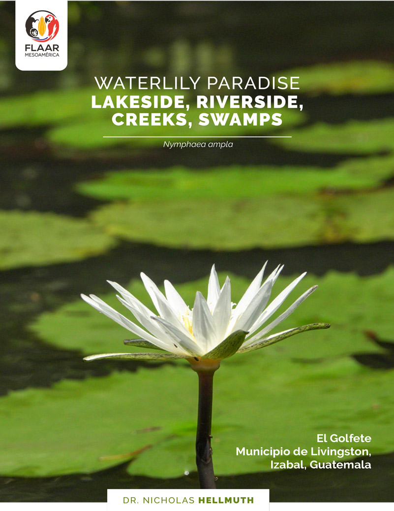
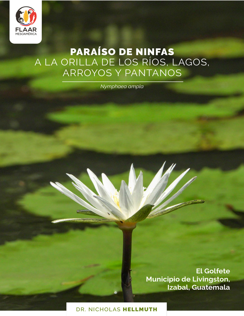
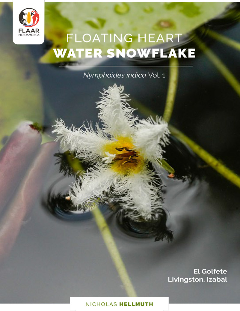
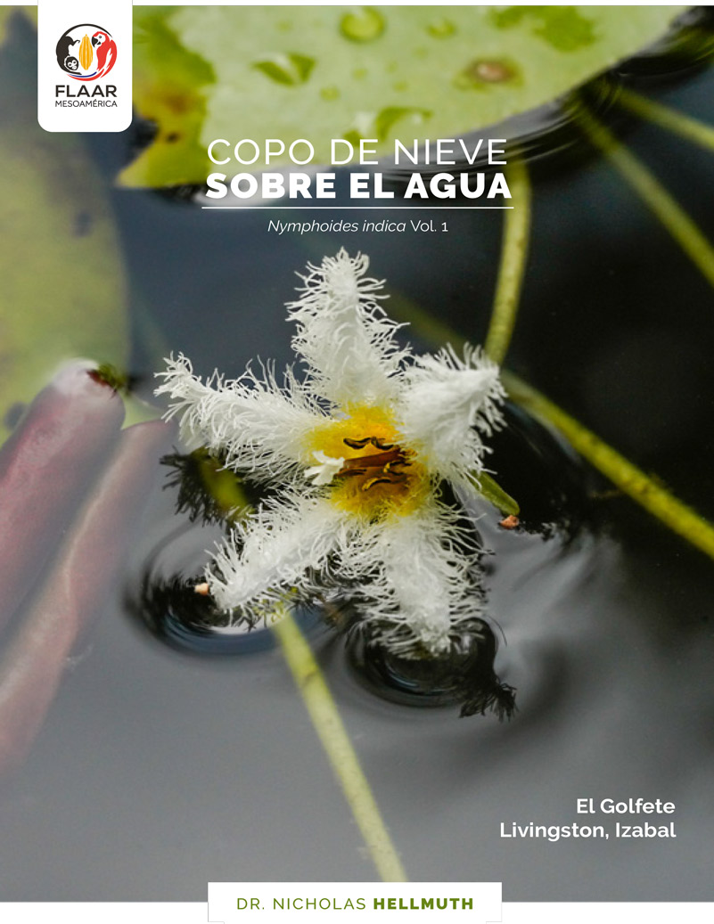
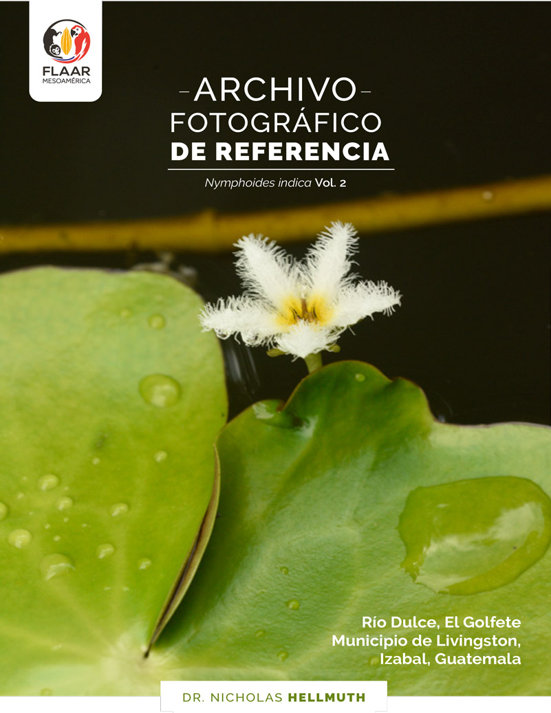
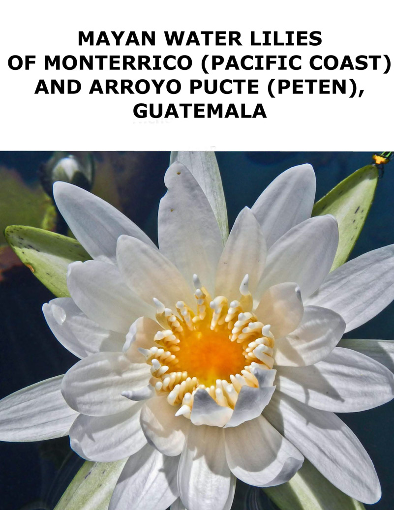
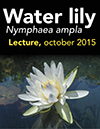
Nymphaea ampla is a water lily I have been studying throughout Guatemala in rivers and lakesides since the 1970’s. But Nymphoides indica is a tiny flowered water lily that I have not previously noticed. We found thousands of this Nymphoides indica along the sides of lagoons and inlets of El Golfete part of Rio Dulce, Municipio de Livingston, Izabal, Guatemala during our field trip in mid-March 2020.
So we are now presenting one photo album on Nymphaea ampla and two photo albums and bibliography on Nymphoides indica of the same area.
Further research is needed: where else is Nymphoides indica found in Guatemala, Belize, Quintana Roo, Campeche, Tabasco, and Chiapas? Does Nymphoides indica prefer brackish water? A bit of salt water from the Caribbean flows into El Golfete, as do Bull Sharks and other creatures from the Caribbean Sea. But if Nymphoides indica is found in Peten, this means it can grow readily without brackish water.
Is a part of Nymphoides indica edible? And how can we find documentation from Aztec, Mixtec, Zapotec, Maya or other ethnohistorical or ethnobotanical studies that Nymphoides indica is or was indeed consumed by people of Mesoamerica. So far there is no evidence (that I yet know of) that this miniature-flowered water lily is a narcotic as is the larger Nymphaea ampla.
Equally crucial, is Nymphoides indica a plant that was present in Mesoamerica before the arrival of the Spaniards? Or, like many plants in wetlands, did it escape from gardens and spread into streams and lakes?
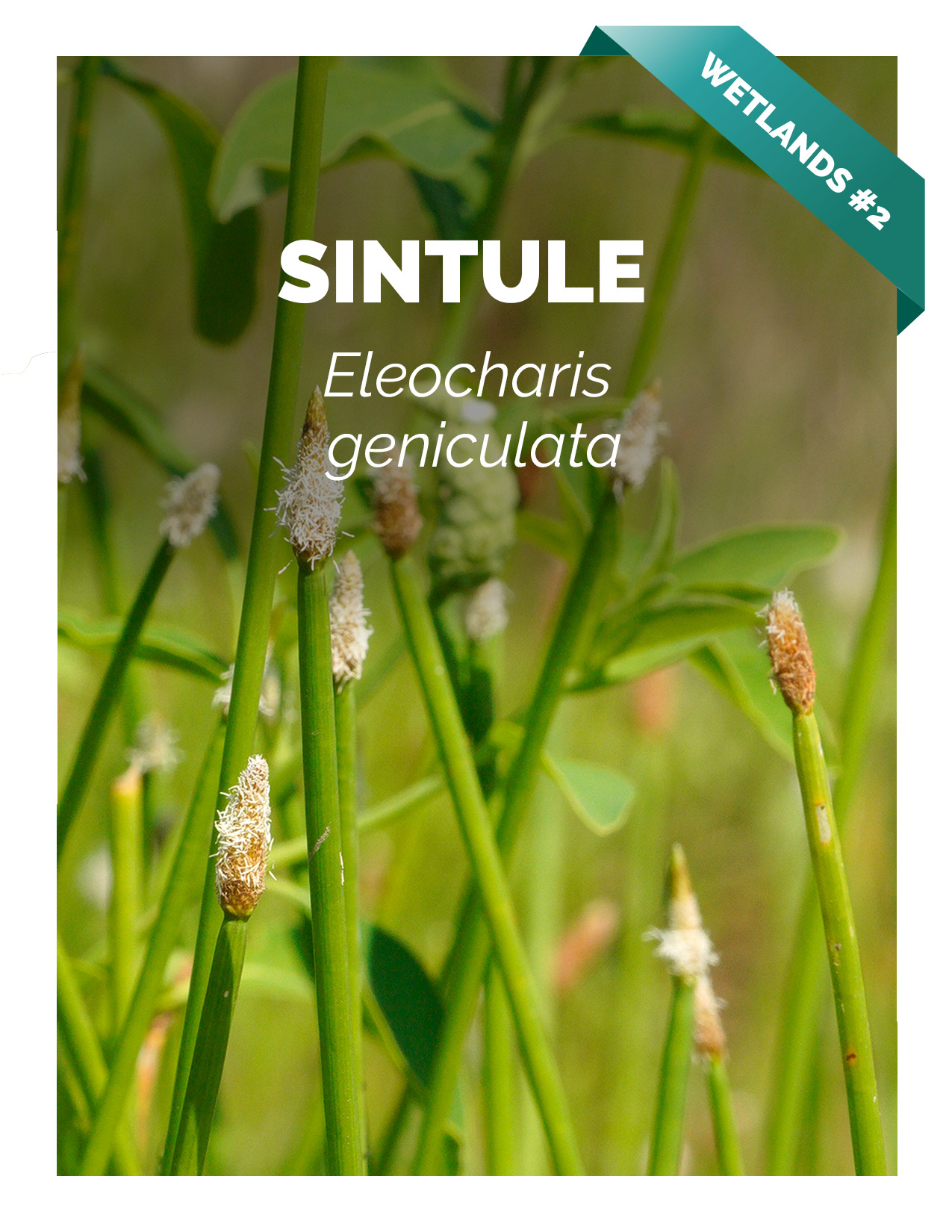
Any area of the world with the tropical temperatures and rainfall of the moist portions of Guatemala will have lots of ferns and fern allies. Normally we (FLAAR, USA and FLAAR Mesoamerica, Guatemala) study trees, bushes, vines and lianas, algae, and lichens. But since we are evolving into studying wetlands and also treetop ecosystems, we will be finding lots of ferns and their relatives.
We found an entire seasonally inundated “Savanna of 3 Fern Species” at the northwest edge of Parque Nacional Yaxha Nakum Naranjo last year. We will now be looking for unique biodiverse ecosystems in the wetlands of the Municipio de Livingston: swamps, marshes, seasonally inundated flatlands, etc. Lots will have terrestrial ferns that prefer to grow in wet areas. So around the photogenic bogs alongside Rio Dulce and inlets and lagoons especially on the north side of El Golfete we will be looking for Acrostichum danaeifolium, giant leather ferns, also known as mangrove ferns.
Plus, up in the tall trees, ferns love to grow on tree limbs. Ericka Garcia and Boris Llamas, of UVG, are very experienced and adept at rappelling up into treetops to study what’s up there.
So once the Coronavirus epidemic has subsided we look forward to finding lots of ferns and fern allies along the Rio Dulce and all the other rivers, lakes, and hills of this part of Izabal, Guatemala, Central America.
El Bosque Estacionalmente Seco de Guatemala: Flora, Fauna y Cultura This book has dozens of chapters, including: Flora, Insectos, Arácnidos, Anfibios, Reptiles, Aves and Mamíferos. So covers Insects, Arachnids, Amphibians, Reptiles, Birds and Mammals in addition to plants. Editors:
Jiichiro Yoshimoto, Universidad del Valle de Guatemala
Daniel Ariano-Sánchez, Universidad del Valle de Guatemala, Centro de Estudios Ambientales y Biodiversidad
183 pages, published by Serviprensa in 2017 which means the information is pertinent and relevant. Information from past decades definitely also continues to be useful, but it helps to have recent documentation also.
My first experience with the corridor de bosque seco parallel to the Rio Motagua was when I took a train from Guatemala City to Quirigua (probably in 1963 or 1964). The train was still in full operation then. Then in the 1970’s, I drove back and forth to do mapping of Yaxha (Peten) year after year after year (so saw the bosque seco out of both sides of my window).
In 2015 I did research on where Plumeria could be found, wild, in Guatemala, so I made several field trips to the dry area parallel to the Rio Sacapulas.
And driving to Copan Ruinas in Honduras I have passed through dry areas of Zacapa every decade since the 1960’s. Since in the 1960’s there were no buses on the final segment to get to the border, I would hitch a ride on top of a cargo truck (so you got a great view; and it cost less than even a 3rd class bus).
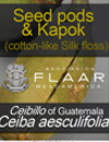
I am really curious about Ceiba aesculifolia, so frequently, year after year, stop to study this the flowers in the evening and the kapok in later months. I am very sad that this May, 2020, it is no longer possible to study the kapok production (which is in May and June for Ceiba aesculifolia on the hills overlooking the Motagua River below). It is not possible to reach the bosque seco area due to highways being closed for Coronavirus spread prevention; no one is allowed to travel from one departamento to another (so we have not done field work since finishing our last field trip (in the Municipio de Livingston, Izabal) on March 15th, 2020).
As soon as it is possible to fly back to Guatemala I will read this book from cover to cover. We thank Dr. Yoshimoto for donating a copy to FLAAR Mesoamerica. We thank Victor Mendoza for receiving the book on our behalf so we can all read it later.
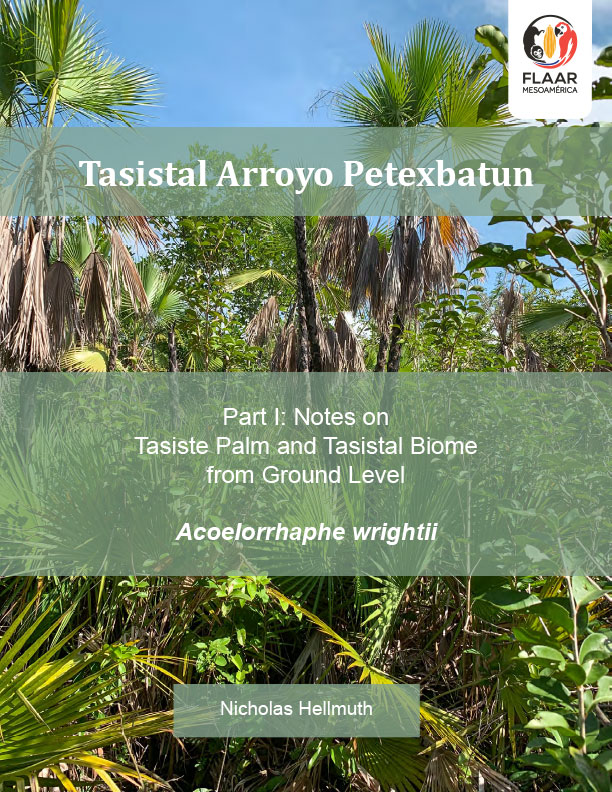
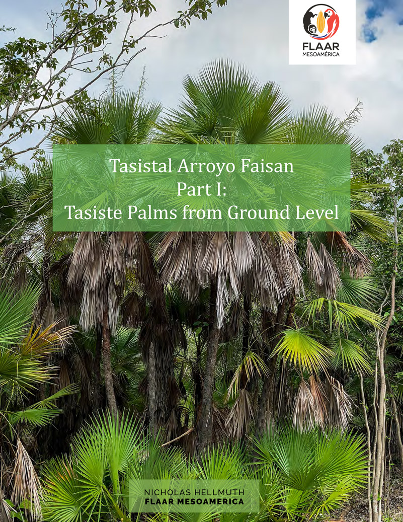
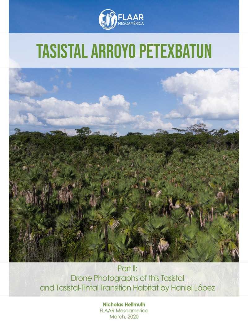
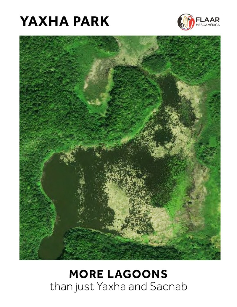
Tasiste palms, Acoelorrhaphe wrightii, grow in clusters; a cluster is perhaps 11 or more stems (trunks) physically next to each other growing from a single root mass. A seasonally inundated savanna could have dozens of clusters. The Savanna East of Nakum had perhaps 100 clusters; the Savanna West of Naranjo had a dozen or so clusters; the Savanna of 3 Fern Species (far west of end of Lake Yaxha and then uphill to a plateau) had a few clusters. Since it takes many hours to hike back and forth, and since camping overnight is not recommended or permitted, no one has yet made complete lists what species of plants are in the rectangular section of this savanna area; we had time to explore only parts of the circular area; much of which is a bog; much has a meter of water plus mud even at the height of the dry season of a really dry year.
A tasistal with tasiste palm trees has maybe 50,000 clusters or 70,000 clusters (we estimate a single tasistal can have up to 1,000,000 stems (in lay person’s terms, almost one million palm trunks). Each stem is a complete tree; just that lots of stems grow next to each other from one circular root mass. Stem is a technical botanical term: they are individual tree trunks of a tasiste palm.
We now have four reports for you to experience this remarkable ecosystem.
Tasistal Arroyo Petexbatun, photos of Acoelorrhaphe wrightii palms from ground level
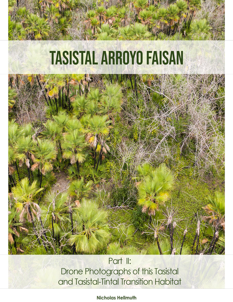
Tasistal Arroyo Faisan, photos of Acoelorrhaphe wrightii palms from ground level
Tasistal Arroyo Petexbatun, drone photos of Acoelorrhaphe wrightii palms.
Tasistal Arroyo Faisan, drone photos of of Acoelorrhaphe wrightii palms.
We appreciate Julian Mariona for telling us about these tasistal areas and the local Sayaxche area guides who took is to Arroyo Faisan and we appreciate the permission of the land owners to visit and study these areas.
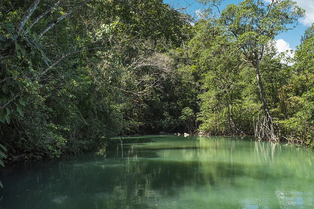
Another place to study Acoelorrhaphe wrightii palms is in the Municipio de Livingston, Izabal, Guatemala. Here we have not (yet) found any savannas; the Acoelorrhaphe wrightii palms here are called pimientilla, and are along the edges of rivers, creeks, and lagoons. The Livingston area Acoelorrhaphe wrightii palms we will publish in June.
This series of photographs of ecosystems of Izabal and Peten is available in two formats, 6MB and 27MB. You can post this, share it, use in in your classrooms presentations (no permission required).
The Spanish original (with video and voice) is already available below. The PowerPoint (in .pdf format, above) is updated with additional written text.