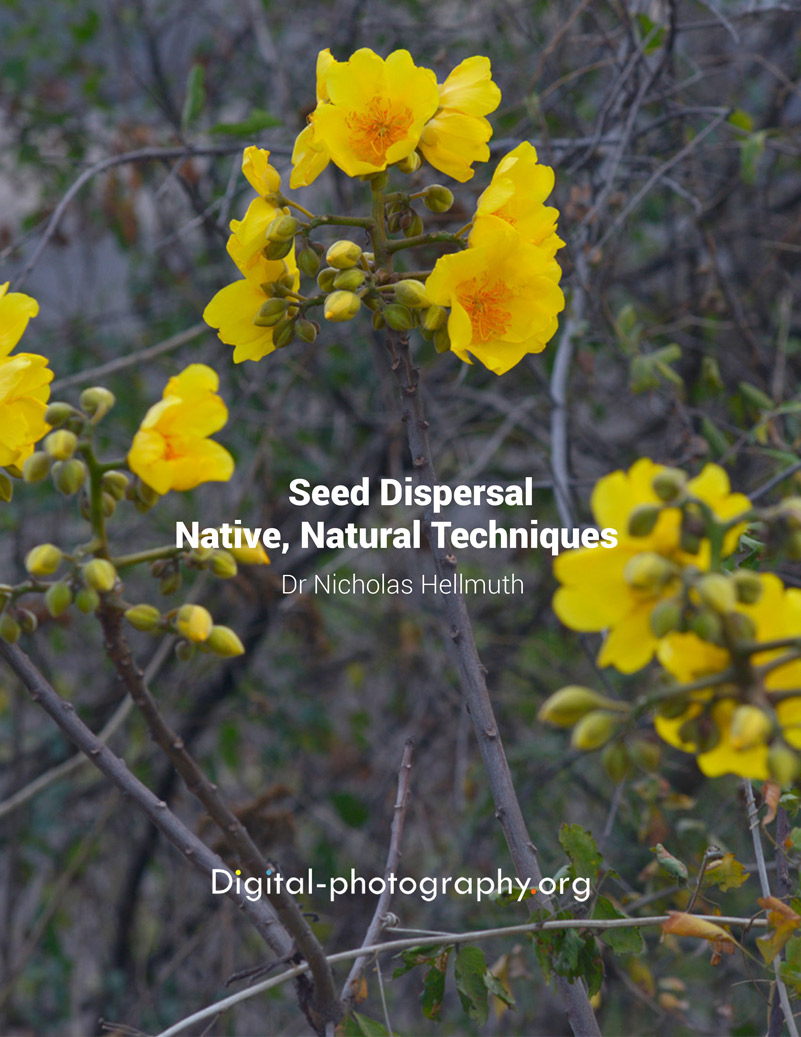
Posted December 24, 2025 Written by Nicholas Hellmuth
This is "Santa Nicholas" being pulled by native deer of Guatemala. The same species of deer that are common throughout the USA are also native and wild even in the rain forests of Guatemala. In Classic Maya art deer are often associated with monkeys—some Maya portraits of deer feature an obvious monkey tail on the deer. And paintings of monkeys often show them with deer antlers and deer ears.
The circular path is the Maya Sky Band with celestial motifs. We have published many PDFs on this topic. Just Google Sky Band Hellmuth FLAAR.
Often the Sky Band is the body of a Bicephalic Cosmic Monster, with "starry-eyed" deer at the left and an upside-down Quadripartite Badge Headdress monster at the right. Just Google Bicephalic Cosmic Monster, crocodile lecture, Hellmuth and you will see lots of Maya art with this cosmic monster.
For year 2026 we will continue with new iconography reports on deer, on monkeys, on bats, on rabbits, on macaws and fish and other native fauna featured in Maya art at the national museum of art and ethnology of Guatemala. The goal is to prepare educational material for the literally hundreds of school groups that visit the museum every month plus the thousands of tourists who also visit this prestigious national museum.
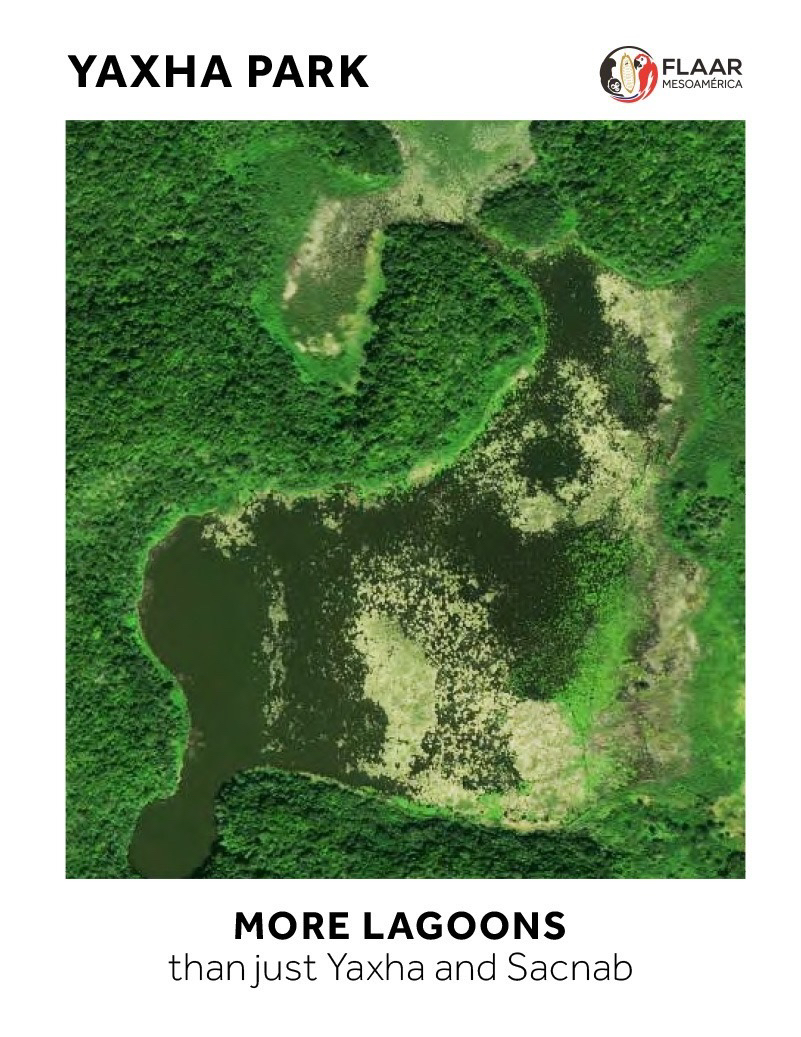
Simultaneously, we will be engaged in field trips and library research on flora, fauna and biodiverse ecosystems of the Reserva de la Biosfera Maya, RBM, Peten, especially of Parque Nacional Yaxha, Nakum and Naranjo (PNYNN) and surroundings.
We now have a new Mavic 4 Pro drone whose aerial camera is significantly better than all previous models that we had in recent years. Most importantly for working in national parks, the Mavic 4 Pro can be flown at eye-level through the forest—so we can show eye-level views in addition to the obviously important aerial views from above.
We also continue our long-range research project on all the hundreds of wild plants, native to Guatemala, have edible parts. With the help of the Q’eqchi’ Maya team that work with us, we are preparing FLAAR Reports on several wild plants of the cloud forests of Alta Verapaz that produce edible food without needing slash-and-burn milpa agriculture.
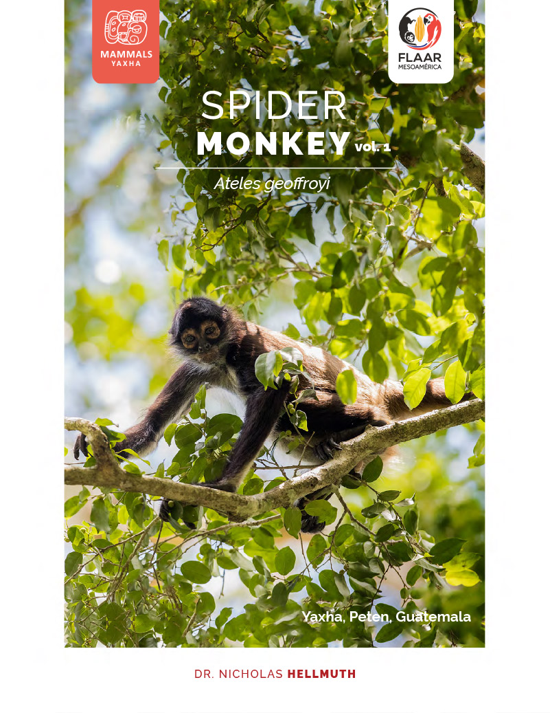
The Maya archaeology sites of Yaxha, Topoxte Island, Nakum and Naranjo-Sa’al have majestic pyramid-temples, multi-story palaces, acropolises, ballcourts, and lots of wide, paved, ancient causeways. PNYNN is literally alongside Parque Nacional Tikal (PANAT), so when you go to Peten to visit Tikal, it’s definitely a good idea to plan to at least visit Yaxha and Topoxte Island (and go up the Rio Ixtinto at least a kilometer to experience all the wetlands plants). You can rent a boat and lanchero at the Yaxha visitors’ center or at hotel El Sombrero Ecolodge. Frankly there is so much to see at Yaxha, Topoxte Island, and Rio Ixtinto that it’s a good idea to spend the night (to enjoy experiencing the howler monkey Alpha Males roaring to tell all the other nearby monkeys that they are really THE Alpha Male howler monkey).
As part of our flora-fauna-ecosystem research project of 2018-2019 organized by the IDAEH co-administrator of PNYNN and the project biologist, we found and photographed lots of species of trees, bushes, and vines that have gorgeous flowers. We show a sample in 15 FLAAR Reports that you can download in the links below.
We are now working at PNYNN, PANAT, PNLT and elsewhere in the Reserva de la Biosfera Maya in a 5-year project of cooperation and coordination with the CONAP forestry conservation entity of Guatemala. So lots more publications to come, especially since now we have a Mavic 4 Pro drone that can literally “fly between trees” so can photograph the tree canopy.
Below are the most extensive photo albums of 15 of the most gorgeous flowers in central Peten.
Vol. 1, Bright Orange Flowers
of Cordia dodecandra,
Nakum Area of PNYNN, Peten, Guatemala
Vol. 2, 4-Petalled Flowers of River Banks,
Lake Shores, and Seasonally inundated Savannas, Ludwigia octovalvis
Vol. 3, Masses of Yellow Flowers,
Genus Combretum,
along road between Yaxha and Nakum, PNYNN
Vol. 4, Flowers and bizarre Bracts
of Calathea lutea,
relative of Heliconia and of Banana
Naranjo-Sa’al and Savanna of 3 Fern Species areas of Parque Nacional Yaxha, Nakum and Naranjo (PNYNN)
Vol. 5, Costus pictus,
Medicinal Flowers,
Yaxha and Naranjo-Sa’al Areas of PNYNN
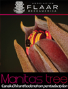
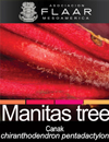
Vol. 6, Piscidia piscipula, Jabin, Dogwood, with Hummingbird Pollinator
Yaxha and Nakum areas of Parque Nacional Yaxha, Nakum and Naranjo
Vol. 7, A beautiful Red Flower,
a Hibiscus Relative,
but the Petals and Sepals never open
Malvaviscus arboreus, Sleeping Hibiscus
Vol. 8, Photogenic
wild Morning Glory Flowers
of Nakum and Yaxha areas of PNYNN
Vol. 9, Photogenic Bright Yellow
Morning Glory Flowers of Genus Merremia
Nakum and Yaxha areas of PNYNN
Vol. 10. Yellow Flower Paradise,
Yellow Flowers Covering the Tree Canopy
Nakum, East of Savanna Bajo, PNYNN
Flowers of Tabebuia donnell-smithii
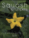
Vol. 11, Yellow Flowers & Fruits
of Wild Undomesticated Squash Vines,
Cucurbita lundelliana
Along the Shores of Lakes and Rivers in Parque Nacional Yaxha, Nakum and Naranjo
Vol. 12, Orange Masses of Flowers
of Parasitic Vine (but does not kill the host)
Genus Psittacanthus,
Yaxha, Blom Sacbe and adjacent Grupo Maler
Vol. 13, Yellow-Orange Flowers
of Trees of the Caesalpinia species,
Fabaceae family
Bajo La Justa, between Yaxha and Nakum, PNYNN
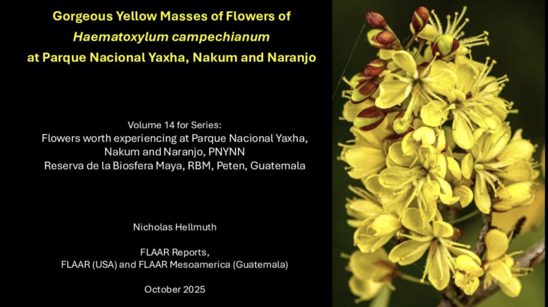
Vol. 14, Gorgeous Yellow Masses of Flowers of Haematoxylum campechianum
at Parque Nacional Yaxha, Nakum and Naranjo
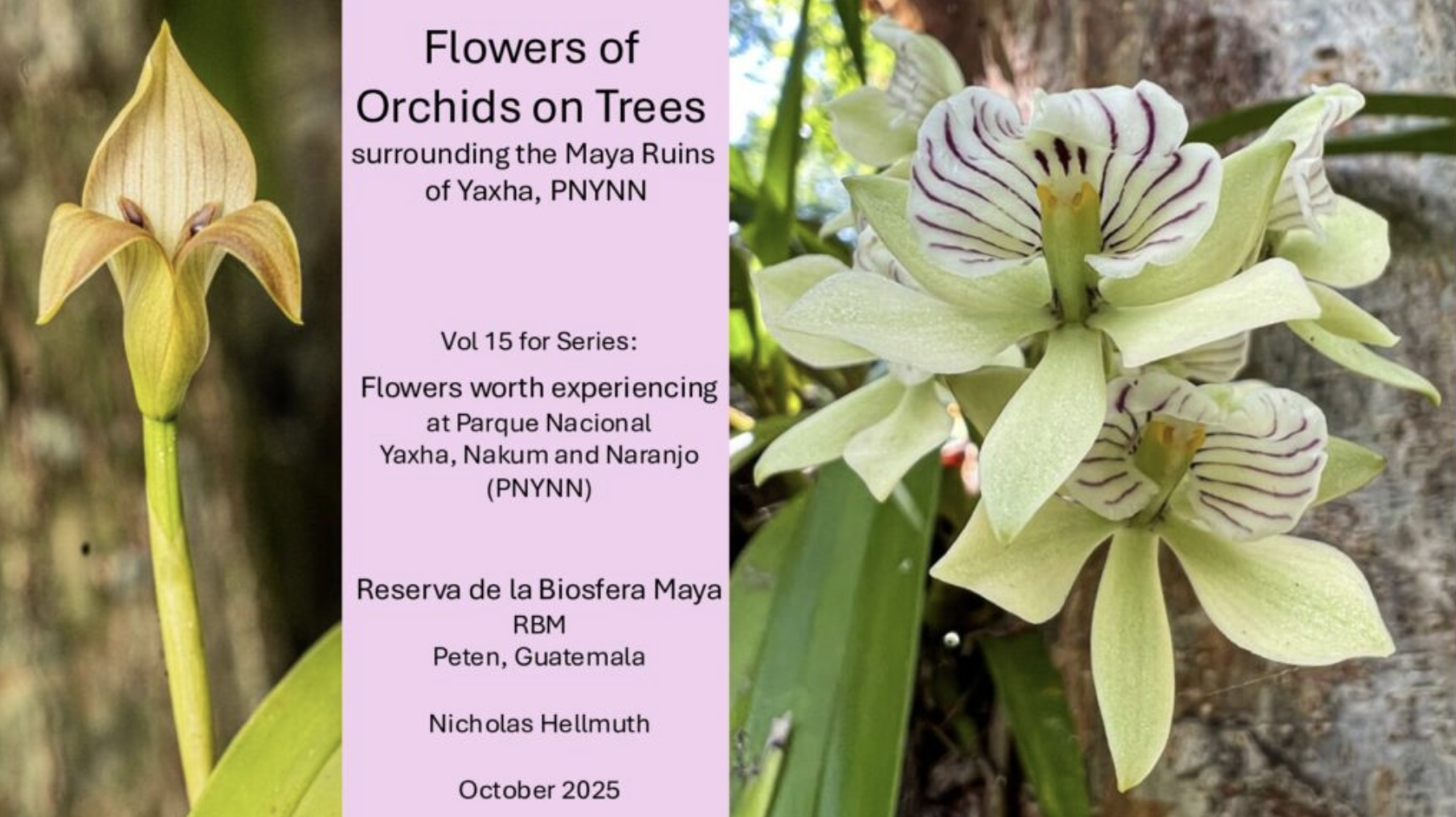
This is being edited by orchid specialist Fredy Archila and will be available as a download later in November
Vol. 15, Flowers of Orchids on Trees
surrounding the Maya Ruins
of Yaxha, PNYNN
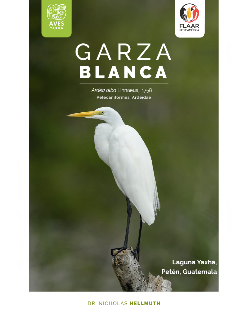
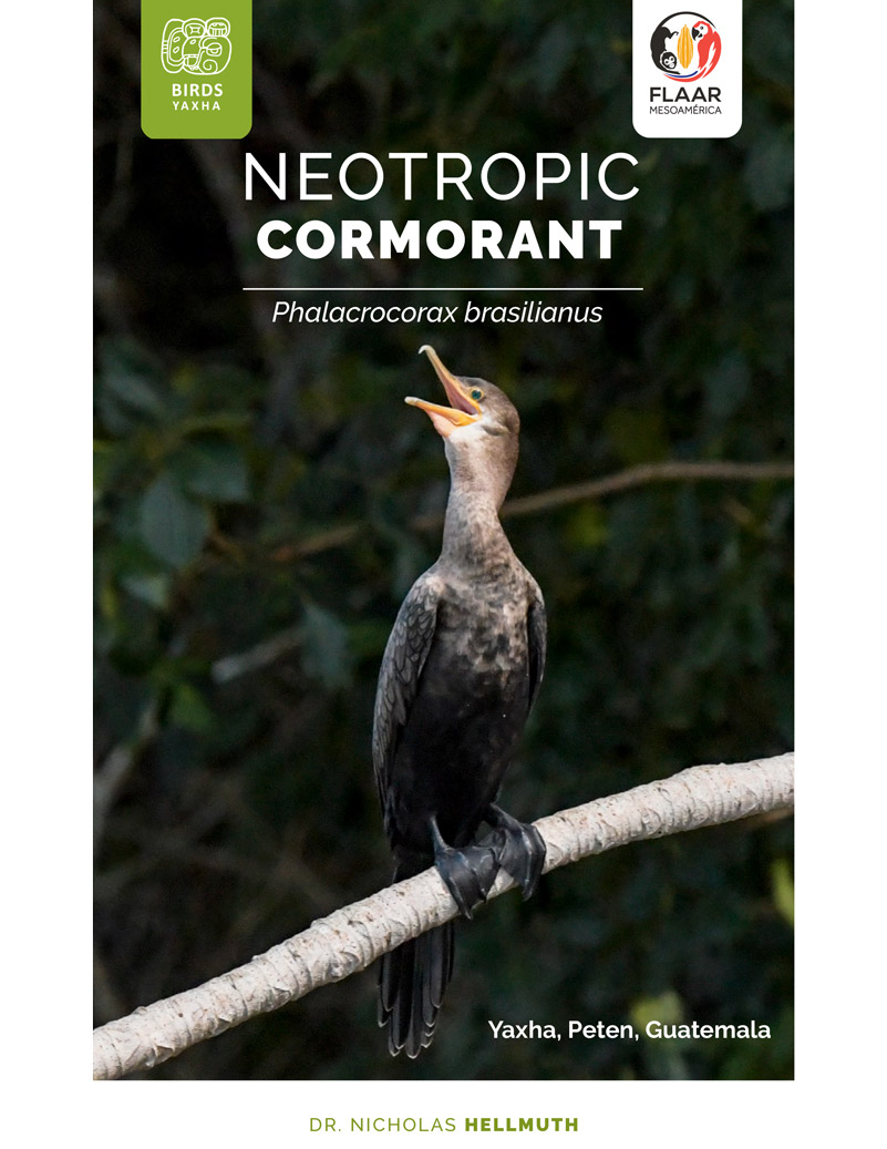
The Maya ruins of Yaxha, Topoxte Island, Nakum and Naranjo-Sa’al are very popular for bird-watchers and eco-tourists. We (FLAAR from USA and FLAAR Mesoamerica, Guatemala) have been accomplishing flora, fauna and ecological field work in this national park since 2018 (in addition to Hellmuth and his team mapping the pyramids, palaces, ballcourts, causeways and house mounds of Yaxha, Topoxte Island and Nakum in the 1970’s).
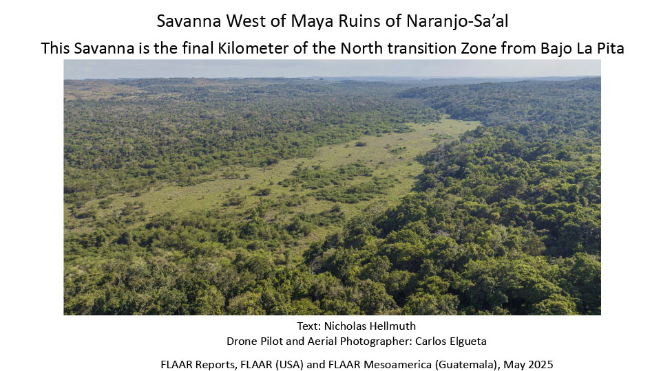
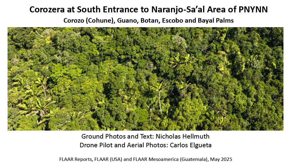
In late April 2025 we did field work with our registered Mavic 3 drone aerial camera and photography from the ground in several locations of impressive bio-diverse ecosystems in the Naranjo-Sa’al part of PNYNN. Here are two FLAAR Reports.
Savanna West of Maya Ruins of Naranjo-Sa’al
This Savanna is the final Kilometer of the North transition Zone from Bajo La Pita
Corozera at South Entrance to Naranjo-Sa’al Area of PNYNN
Corozo (Cohune), Guano, Botan, Escobo and Bayal Palms
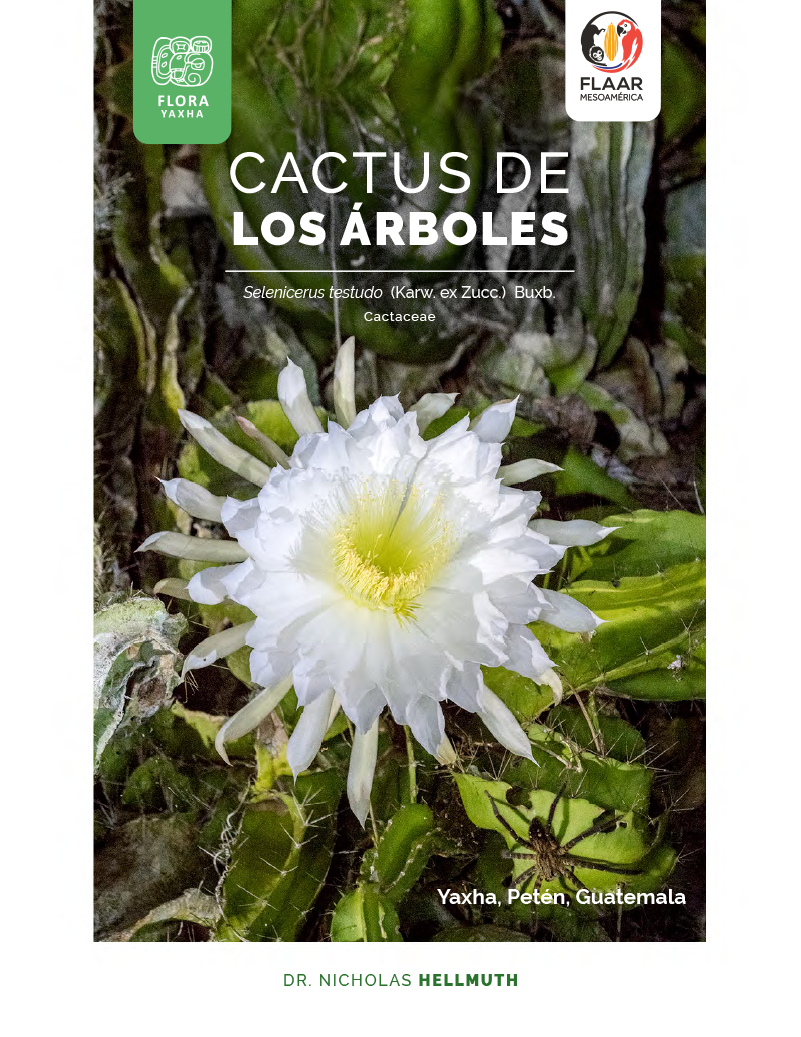
There are hundreds of species of cactus plants in Guatemala. A few arboreal (climbing) cactus vines are in Peten. Selenicerus testudo is found in front of pyramid Temple 216 at Yaxha. But most cacti in Guatemala are in the rain shadow of the Sierra de las Minas (to the south, in El Progreso, Zacapa, Chiquimula). Plus there are cacti in other seasonally dry forests of Guatemala.
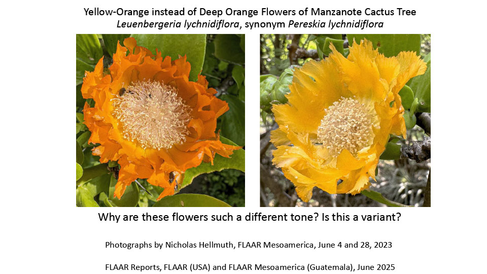
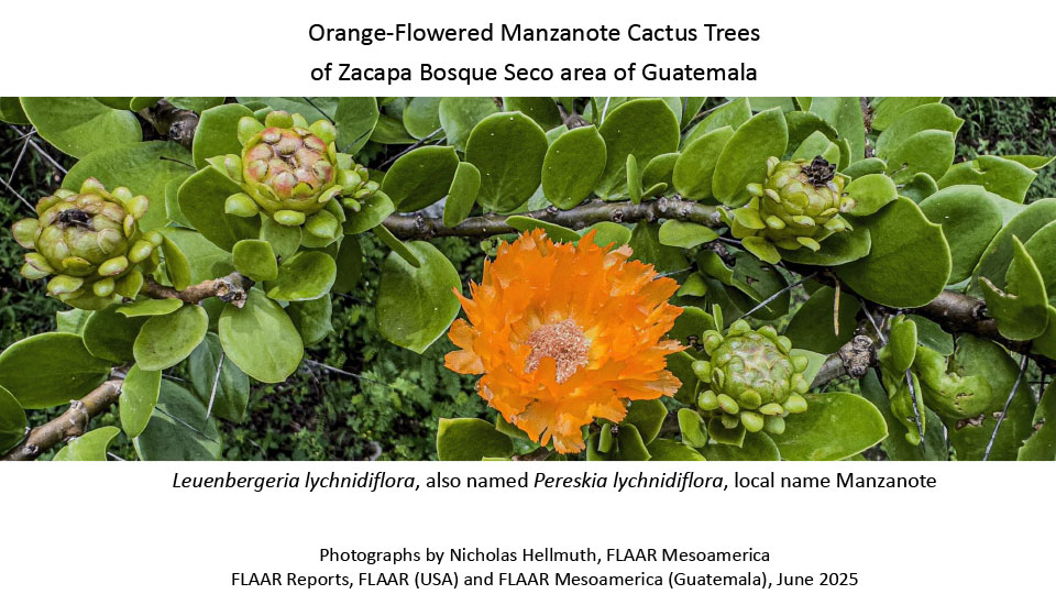
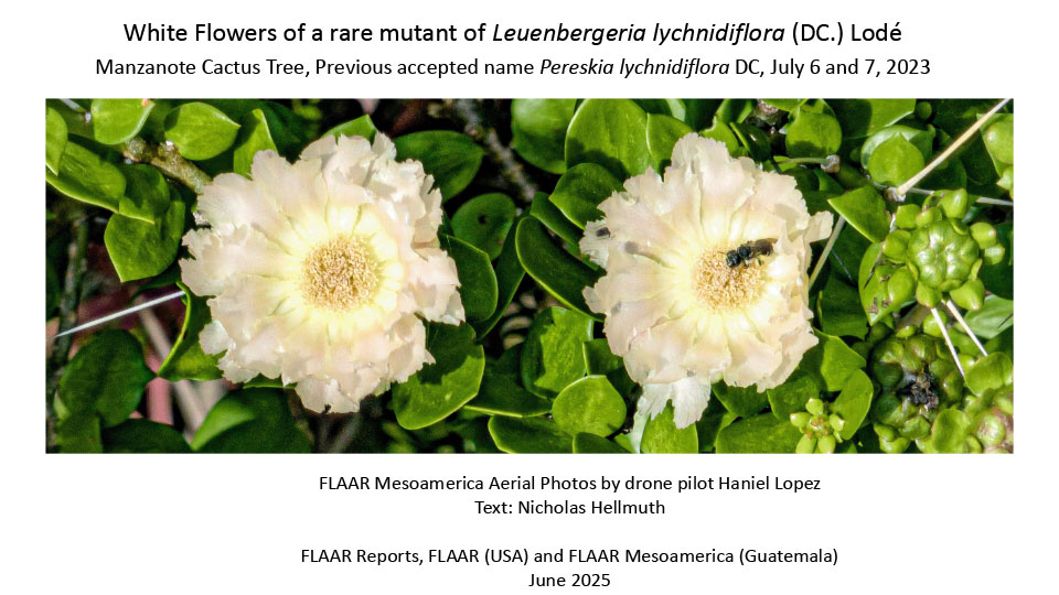
Several species of cacti are as high as a one-story building. Many even have a trunk and “branches”. But there is one species that is high as a two-story building and has a trunk, smooth bark, limbs, branches, twigs and leaves all over the place. This cactus tree is in most databases and web pages as Pereskia lychnidiflora DC, but other cactus botanists prefer the newer accepted name of Leuenbergeria lychnidiflora (DC.) Lodé. Its common name in Zacapa area of Guatemala is manzanote—obviously has other names in other parts of Mesoamerica.
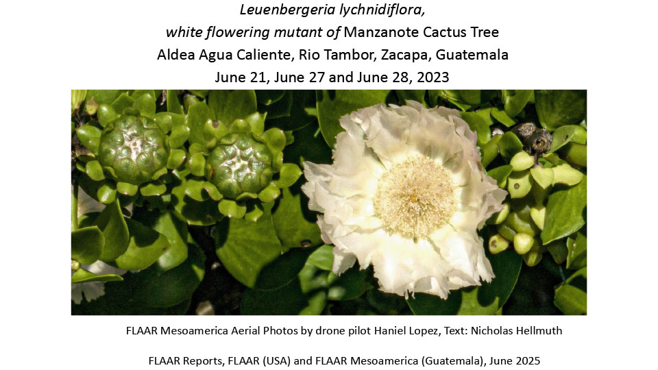
We now have two FLAAR Reports on the common orange-flowering manzanote tree cactus, which we show below. Plus we have five FLAAR Reports on the two unique white-flowering mutants that the FLAAR team found on June 21, 2023. On the present page we make available downloads of all seven photo albums.
Yellow-Orange instead of Deep Orange Flowers of Manzanote Cactus Tree Leuenbergeria lychnidiflora, synonym Pereskia lychnidiflora
Why are these flowers such a different tone? Is this a variant?
Orange-Flowered Manzanote Cactus Trees of Zacapa Bosque Seco area of Guatemala, Leuenbergeria lychnidiflora, also named Pereskia lychnidiflora, local name Manzanote
Leuenbergeria lychnidiflora, white flowering mutant of Manzanote Cactus Tree
Aldea Agua Caliente, Rio Tambor, Zacapa, Guatemala
June 21, June 27 and June 28, 2023
Published June 2025
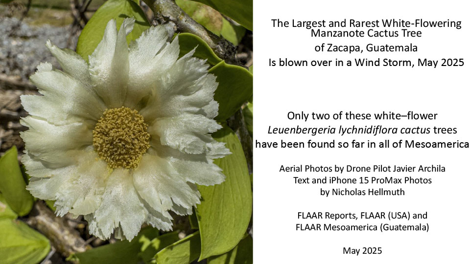
The Largest and Rarest White-Flowering Manzanote Cactus Tree
of Zacapa, Guatemala
Is blown over in a Wind Storm, May 2025
Only two of these white–flower Leuenbergeria lychnidiflora cactus trees
have been found so far in all of Mesoamerica
If you are interested in seeing and experiencing giant cactus trees--tree trunk, bark, limbs, branches, twigs, leaves—we would appreciate a tax deductible donation for obtaining the Mavic 4 Pro drone camera here in Guatemala, with Fly More Combo 512GB, $4,000 (to also have additional batteries). Contact biologist Vivian Hurtado, manager of FLAAR field trips. FLAAR (USA) can send a signed tax deduction donation receipt to you. This email address is being protected from spambots. You need JavaScript enabled to view it..
Leuenbergeria lychnidiflora, white flowering mutant of Manzanote Cactus Tree Aldea Agua Caliente, Rio Tambor, Zacapa, Guatemala
June 21, June 27 and June 28, 2023
Published June 2025
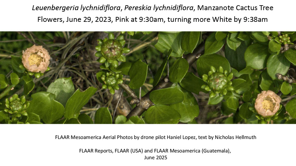
Leuenbergeria lychnidiflora, Pereskia lychnidiflora, Manzanote Cactus Tree
Flowers, June 29, 2023, Pink at 9:30am, turning more White by 9:38am
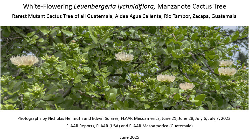
White-Flowering Leuenbergeria lychnidiflora, Manzanote Cactus Tree
Rarest Mutant Cactus Tree of all Guatemala,
Aldea Agua Caliente, Rio Tambor, Zacapa, Guatemala
If you want to join the FLAAR team (consisting of Dr Nicholas Hellmuth, drone pilot and photographer and two assistants) if you can both cover the cost of the field trip (two vehicles and their diesel fuel, one for you (and your friends or family) plus basic hotels, and also donate to cover the cost of the Mavic 4 Pro combo aerial photography system, you might enjoy the memorable experience to be with us on a future field trip. We also will have a field trip to find wild frangipani flower-trees, Plumeria, in the karst mountains of Alta Verapaz in May 2026. For that your donation can also help us obtain the Sony 400-800mm telephoto zoom lens, with a circular polarizing filter. We need that lens in addition to the drone. A driver will be assigned so you can relax during the field trip and look out all the windows to see the amazing Neotropical world that we drive into. And we have a November 2025 field trip to study morning glory plants in both the Maya Highlands and also the desert-like cactus forests of central Guatemala. We have found two species of morning glory “vines” that are actually complete trees. You will see and experience biodiverse ecosystems you have never seen before.
Plus in early January 2026 we will explore Yaxha, in Parque Nacional Yaxha, Nakum and Naranjo, as part of our long-range Palm Paradise Peten Project.
Most field trips are about one week. The morning glory field trip may be a few days longer.
If you would like to donate and participate in your home via ZOOM, we can send you photos and videos every day (that we have Internet in remote areas).
Posted August 25, 2025 Written by Nicholas Hellmuth
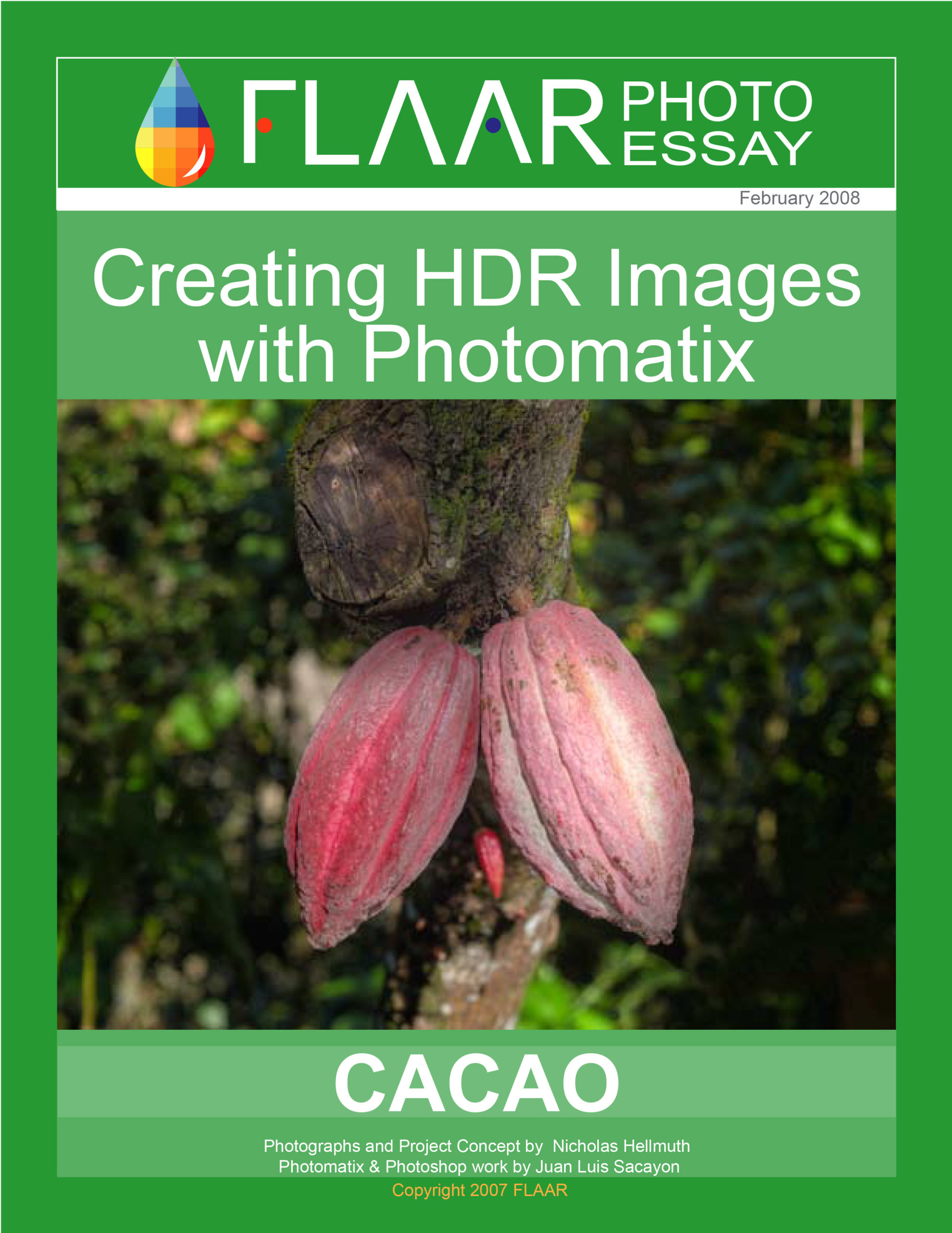
We warmly invite you to join us for the Universidad Francisco Marroquin, lecture: Trees, Beverages, and Maya Cacao Glyphs, where we will explore the fascinating world of cacao in ancient Maya culture. Discover the symbolic role of trees, the importance of cacao-based beverages, and the rich legacy preserved in Maya glyphs. This event offers a unique opportunity to connect history, culture, and tradition, while deepening our appreciation of one of the most cherished plants of Mesoamerica.
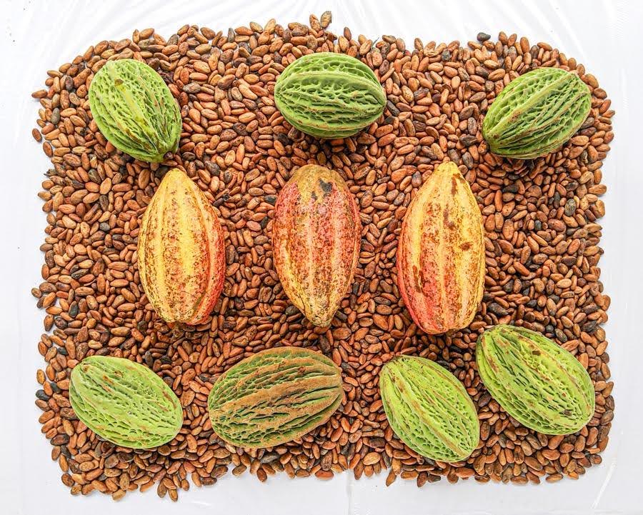
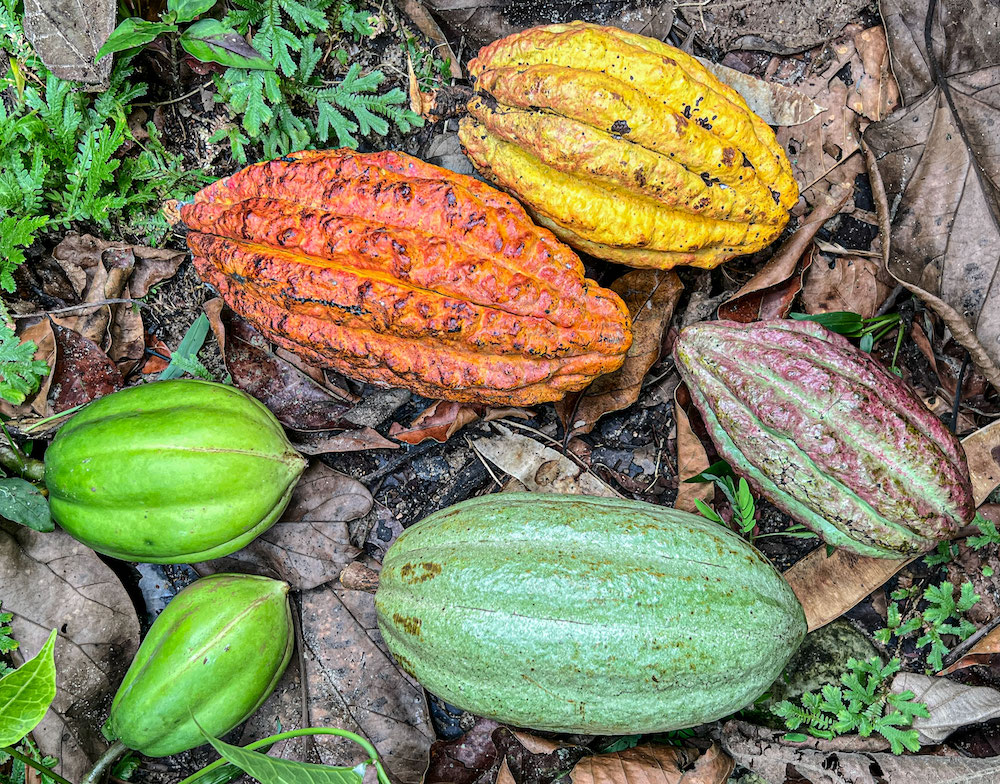
Discussion of the two different native species of cacao plus lots of other seed pods that are the same size as cacao pods. This is the first publication that gently suggests that the trees pictured on the oft-published Highland Maya vase of the Museo Popol Vuh, UFM, feature the small flowers and fruits of Crescentia trees<—not cacao whatsoever.
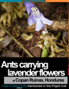
Rare photos of leaf-cutting zompopo ants carrying flowers instead of leaves. The Popol Vuh clearly discusses ants carrying leaves in Xibalba.
Although the book of the Popol Vuh was found in the Quiche area of Highland Guatemala, most of the flora and fauna featured are from the Maya Lowlands (especially of Peten). In other words, the Highland Maya adapted a Lowland treasure of Maya myths. The dynastic history segment of the Popol Vuh is Highland—but most sacred plants and animals are from the Lowlands. In other words, every regional kingdom thousands of years ago had their own regional version—their own dynastic history—but with the mythical flora and fauna not significantly changed from the Maya Lowland origins.
This PDF is in PowerPoint (horizontal) format so we can show photos of flora and fauna at a large size on your computer of tablet.
Thursday, Aug. 28, 2025, 7pm, Museo Popol Vuh, Universidad Francisco Marroquin, lecture Maya Cacao Trees, Maya Cacao Drinks, Maya Cacao Hieroglyphs,
And Cacao Pods shown in Classic Maya Art and Tiquisate Style Ceramic Female Portraits Revelation of LOTS of other Native Fruits of Guatemala are same Size and Shape as Cacao Pods.
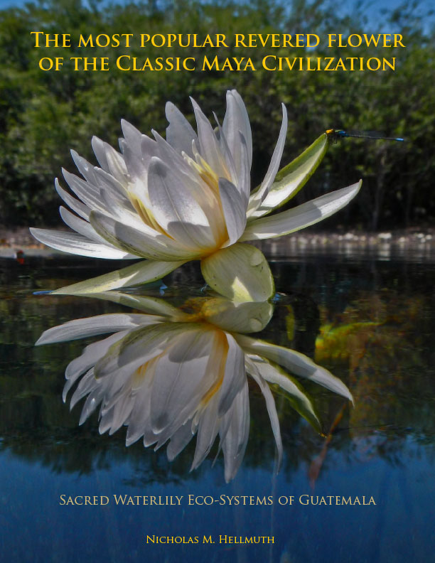
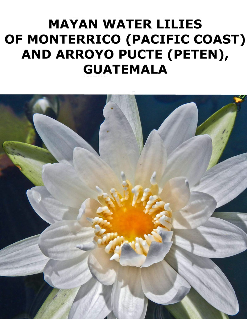
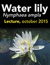
Available for you to share with everyone on social media and send as an attachment is a monumental 207-page photo album of high-resolution photos of waterlilies of Maya rivers and lagoons of Guatemala.
The waterlily is the flower most often pictured in Classic Maya art—it is debated to what extent it is potentially hallucinogenic and to what degree it was used to imbibe by the Classic Maya. A publication in Mexico about 4 years ago features the water lily as a popular drug for the Classic Maya, but what is needed is more lab tests to determine what part of the plant was used and how it was prepared. I say this because in past decades some Peteneros said the plant had edible parts with no hallucinogenic effect.
The most popular revered flower
of the Classic Maya Civilization, Sacred Waterlily Eco-Systems of Guatemala
This photo album of the Maya water lily is an example of decades of FLAAR research on flora, fauna and ecosystems, especially wetlands.
The front cover is normal single-page size but the PDF is horizontal page format so can be used by professors to project for their classroom lectures.
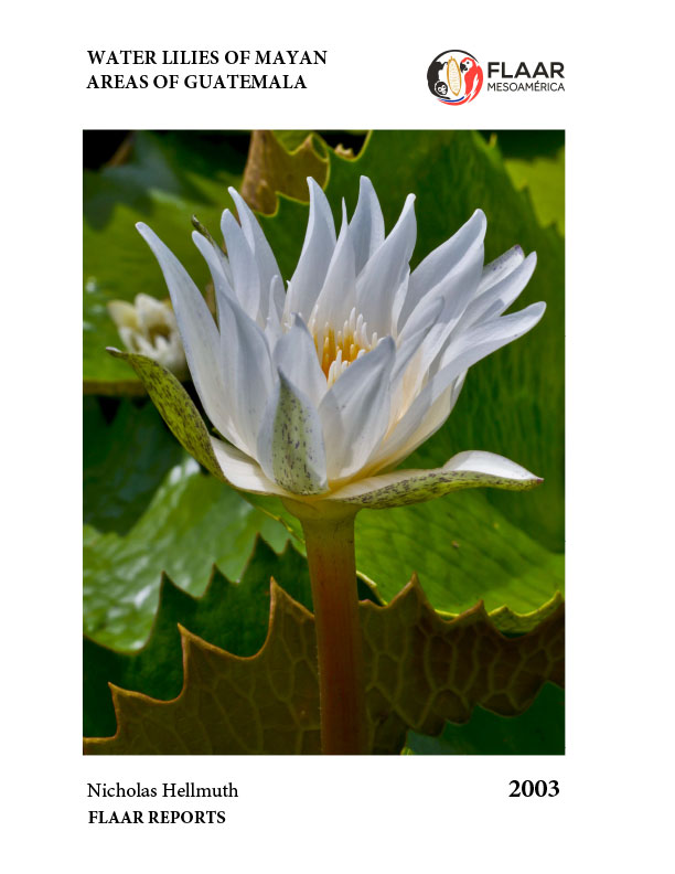
Water Lilies of Mayan Areas of Guatemala
Gorgeous full-color photos at full-page size.
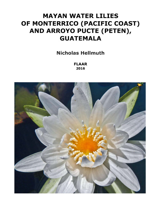
Mayan Water Lilies of Monterrico (Pacific Coast)and Arroyo Pucte (Peten), Guatemala.
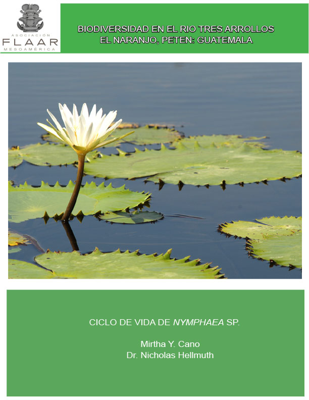
Biodiversidad en el Rio Tres Arrollos, El Naranjo, Peten: Guatemala, Ciclo de Vida de Nymphaea Sp.
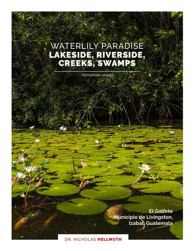
Waterlily Paradise, Lakeside, Riverside,
Creeks, Swamps, Nymphaea ampla, El Golfete
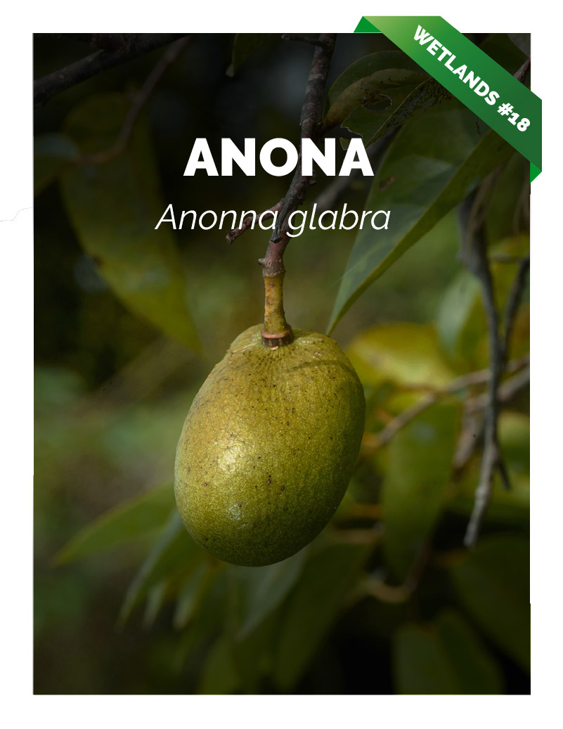
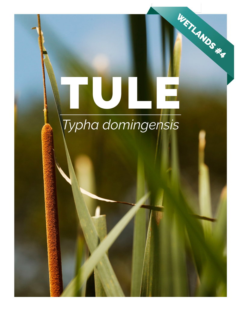
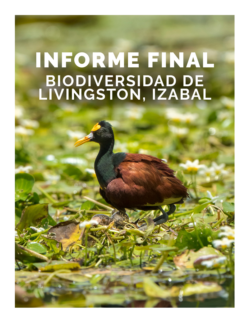
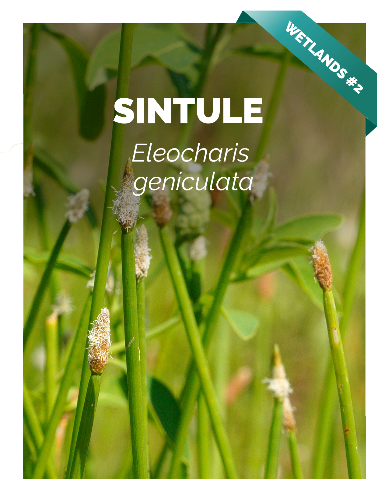
Municipio de Livingston, Izabal, Guatemala
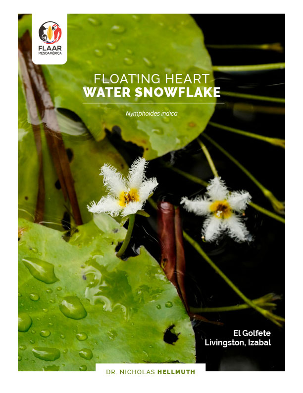
Floating Heart, Water Snowflake, Nymphoides Indica, El Golfete. Livingston, Izabal
The research team at FLAAR (USA) and FLAAR Mesoamerica (Guatemala) have been studying water lily flowers in remote parts of Guatemala for many decades.