When time and funding permit, each flower (each plant species) will have its own page, and its own PDF, and eventually its own PPT so that professors and students have plenty of material on Guatemala (and Honduras, etc) to study.
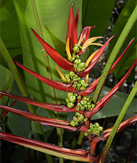
Heliconia adflexa, Coban, Guatemala, Hotel Monja Blanca, FLAAR, by Nicholas Hellmuth
This space is for flowers
we have recently found and photographed.
 |
 |
 |
 |
 |
 |
 |
 |
 |
 |
 |
 |
 |
 |
 |
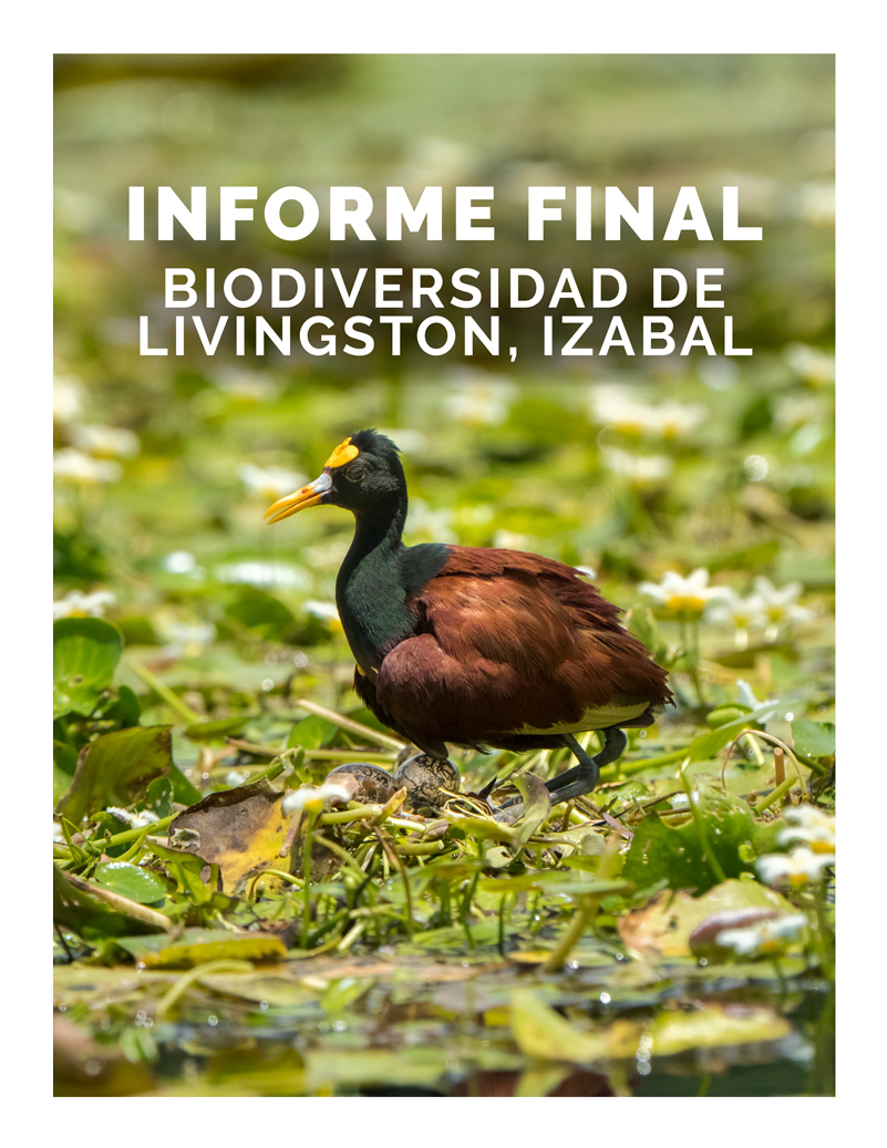
Reports by FLAAR Mesoamerica
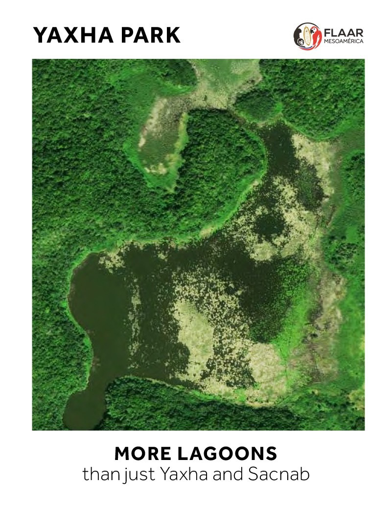
on Flora & Fauna of Parque Nacional Yaxha Nakum Naranjo
Peten, Guatemala, Central America
|
| Share
|
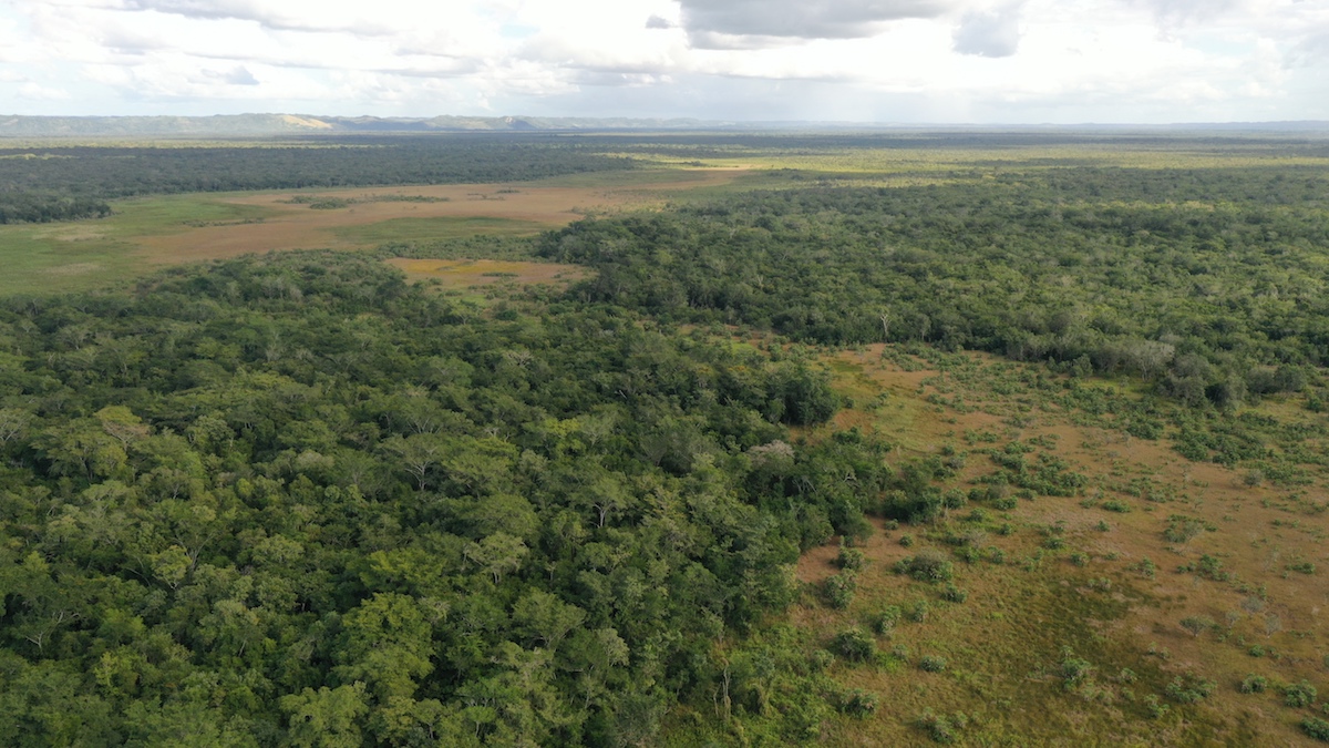
| Biodiversity of habitats of grassland savanna ecosystems of Parque Nacional Laguna del Tigre. |
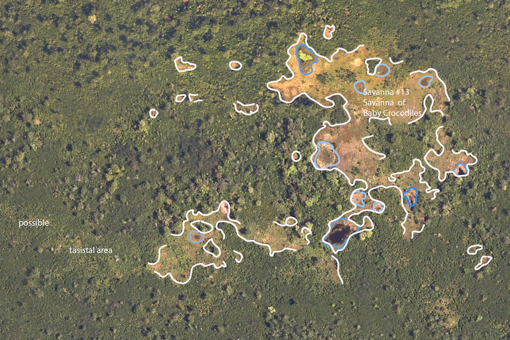
PNLT, Savanna #10, Savanna Video #1 Introduction to the 35 biodiverse ecosystems in far Southeast of PNLTThe three most common kinds of savannas in the southern half of the Reserva de la Biosfera Maya are:
Once we explore the 70+ savannas of Municipio San Jose (near east side of Municipio San Andres, west of Uaxactun) we will have other categories since many of those 70+ savannas have aguadas, water pools, or lagoons in them. There is no pine in any savanna (that we have yet found) in the Reserva de la Biosfera Maya (RBM). Lots of pine in savannas of southern Peten and Belize. The pine-oak area a few kilometers northeast of the northeast border of Tikal has no aerial photographs available and no satellite image shows any open savanna-like space there. We are preparing the videos one-by-one. We will post each video when it is finished. Should have at least several posted this week (then we are a thousand kilometers round trip deep in the rain forest in another part of the RBM, Peten, Guatemala, on Phase 3 of the savanna segment of our on-going project of cooperation and coordination with CONAP to study, photograph, research, and prepare reports on the flora, fauna, and biodiverse ecosystems of the RBM). Assuming that the crocodiles and pit vipers don’t get us, we will be back in the office in mid-May so then more videos of the PNLT Savanna #10 series will be posted on this page.
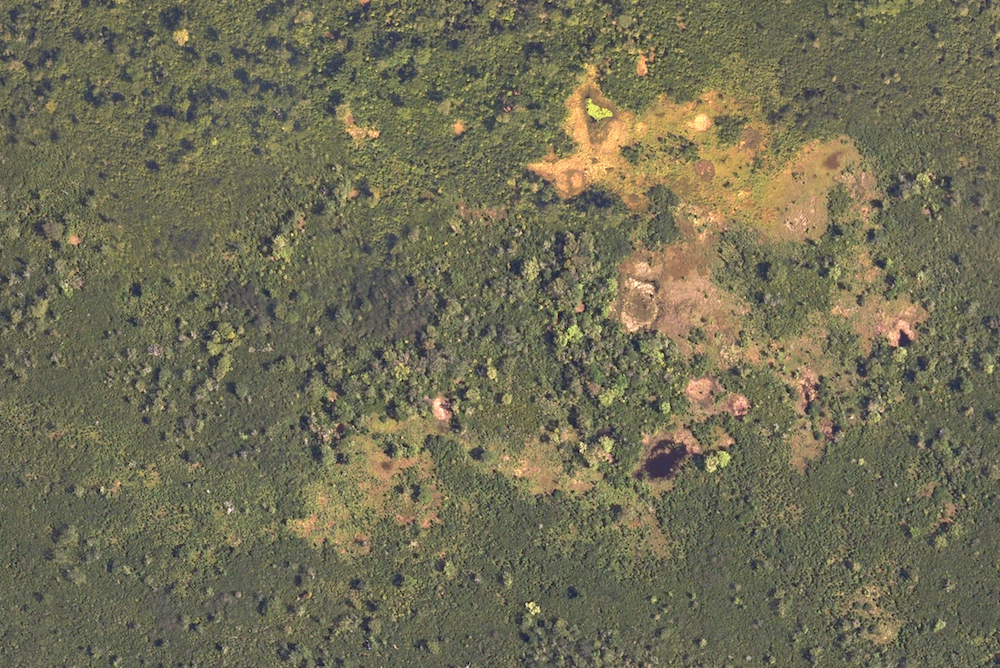
Curious, Unexplained Rectangular Patterns of green Grass Shown by soil and/or Linear Borders of Grass or Tree Areas PNLT, Savanna #10, Savanna Video #2When you enter Savanna #10 you immediately notice that the bright green grass areas have a linear edge on some sides. You see more of this in the savanna in front of the transition zone (from the grassland into the bajo forest vegetation). Savanna East of Nakum (Parque Nacional Yaxha, Nakum and Naranjo, PNYNN) has rectangular areas (of Thalia plants). This again raises the question of whether these areas were worked by the Classic Maya over a thousand years ago. It is unlikely these lines or rectangular area borders are from modern agriculture because it is unlikely there has been milpa agriculture in these savannas. Savanna Video #2 shows all these areas. Would help for a soil scientist and botanist and archaeologist to study these areas to ascertain why the vegetation changes so many times in different areas of the savanna. But unless these curiosities are shown to the world, no ecologist will know they exist and where they can easily be studied. Most of the savannas of southern Peten have been turned into cattle ranches or commercial plantations. So it would help to study the savannas of PNLT, PNYNN, and Municipio San Jose while they still have tapir and crocodiles feeding in them instead of cattle.
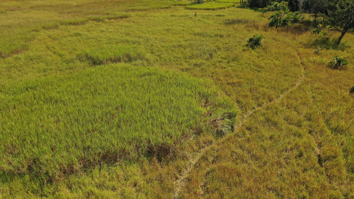
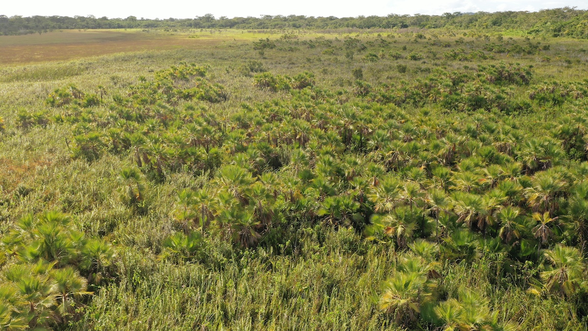
Transition Zone along the north side PNLT, Savanna #10, Savanna Video #3I use the concept of transition zone to talk about where the savanna vegetation merges with the surrounding bajo forest vegetation. Lots of bushes, vines, and trees. One challenge is to recognize where the bajo forest is encroaching on the tasiste palm areas of the savanna. On a projection screen in your classroom you and your students can see the biodiversity: the vegetation changes every 60 to 80 meters. I notice the different kinds of plants while hiking through this area. I see even more detail on a 32-inch 4K HMDI monitor (using the RAW file version from the drone). Lots of tasiste palms around the edge; often quite thick. Lots of bushes and vines; also ferns. Hibiscus (wild hibiscus native to Guatemala) is abundant. Lots of the plants of a savanna are edible. The bajo forest is always eager to spread into a savanna; but the soil and moisture of a savanna are probably not identical to that of the bajo. Plus the savannas are burned every one, two, or three years. Most bajo forest trees can’t survive such a fire. But tasiste palms and calabash trees survive; grass and sedges also sprout up quickly when rains begin after the fire. Area of thick clusters of tasiste palm, like a miniature tasistal area PNLT, Savanna #10, Savanna Video #4Savanna #14 is part tasistal part grassland savanna. Savanna #25 has several open grasslands but has substantial areas of tasistal on the northeast and southeast. Savannas #23, 24 and to the southeast are solid tasistal habitats. Savanna #10, the subject of this video, has widely scattered tasiste palms in several areas, especially the northern part. But out in the center the tasiste palms get so close together that I would almost consider this area as a potential tasistal habitat.
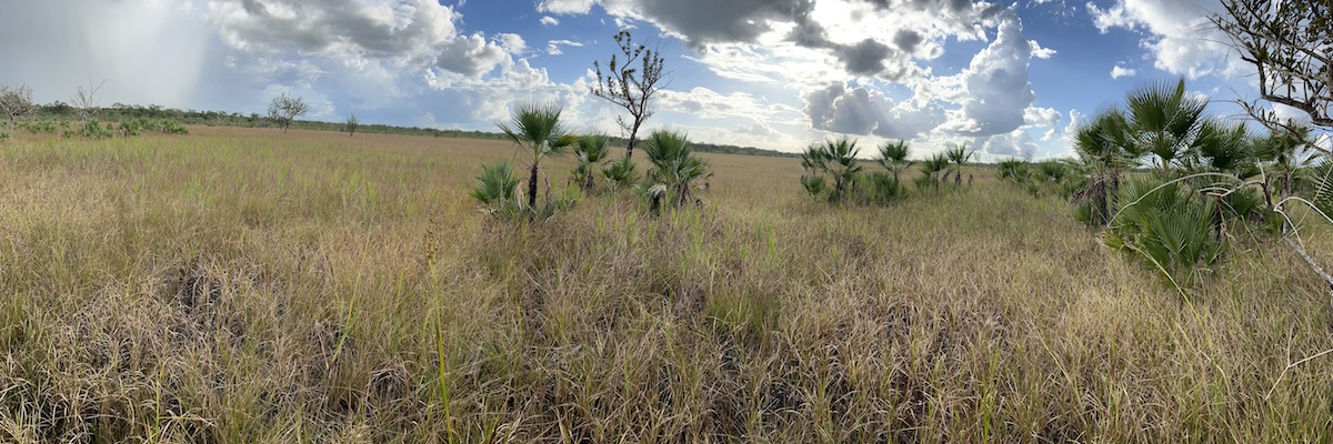
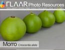
Wide open grassland area with lots of widely scattered Crescentia cujete, calabash trees, morro PNLT, Savanna #10, Savanna Video #5Savanna #10 is a traditional (RBM Maya Lowlands) grassland savanna. Crescentia cujete trees are easy to see; tasiste palm clusters are in many areas. Nance is surely present (but not as easy to spot as a calabash tree). There are some oak trees in the southern transitional zone to the bajo. In this part of Peten (and in PNYNN) calabash trees and tasiste palms grow “only” in savannas. They can be planted in a garden anywhere, but out in the wild, so far, I have seen them only in savannas (in Peten; in eastern Izabal tasiste palms grow primarily along shores of rivers or lagoons with brackish water: no savannas here and no tasistal areas; clumps of tasiste palms are never massive whatsoever in the Municipio de Livingston). This short video shows where most of the calabash trees can be seen in Savanna #10.
Circular areas of green grass and/or soil, mostly at the center towards the east PNLT, Savanna #10, Savanna Video #6Rectangular and linear aspects of the savanna are in Video #2. Most are on the west end and middle of the northern area of the savanna. The present Video #6 shows circular areas of grass or soil that are a different color than the surrounding savanna. I show these so that archaeologists and soil scientists can discuss whether any of these patterns are a result of the Classic Maya utilizing this savanna for over a thousand years.
Connecting area from Savanna #10 into adjacent Savanna #11 PNLT, Savanna #10, Savanna Video #7Savanna #10 has a corridor to adjacent Savanna #11. Many other savannas in PNLT are near an adjacent savanna. In theory you could consider #10 and #11 a single savanna but I prefer to name them separately. Otherwise a report on both together would be too many pages. At the north part of the corridor, there is a grass area with a straight diagonal border (where trees of the bajo border the grassland savanna). Is this a natural straight border or was there a modification of this part of the savanna by the Classic Maya? I discuss this topic in Video #2 and Video #6.
These videos may be used in your classroom presentationsNo permission is required; simply use the videos in your classroom presentations or in your reading assignments. There are other FLAAR Reports on this White Water Lily Savanna (official name is Savanna #10). Both PDFs and videos of FLAAR can be used in classroom presentations with no permission required. We also have lecture topics available “in-person” via Zoom by Nicholas Hellmuth. Or in-person with an airplane ticket (nowadays ZOOM or Google Meet is less expensive than airfare, hotel and meals). Initial Bibliography on savannas:So far, no photographic focus on the biodiversity: lists, yes; discussion, yes; maps, yes. But not many aerial videos of savannas of Peten or Belize. www.youtube.com/watch?time_continue=2&v=QuLmUTpP7jA&feature=emb_logo www.youtube.com/watch?v=gEZVlS4My4w www.isfmi.org/resources-1/fire-leadership-for-protected-areas-in-belize www.youtube.com/watch?v=xgCOBNw3t-A https://www.youtube.com/watch?v=4Edmp3-ChTY&feature=emb_imp_woyt https://newmedia.ufm.edu/video/dinamicas-culturales-y-naturales-de-la-cuenca-mirador/ www.sidmartinbio.org/which-south-american-country-has-savannas/
First posted May 1, 2022. |

Parque Nacional Yaxha, Nakum and Naranjo
Carnivorous Plants
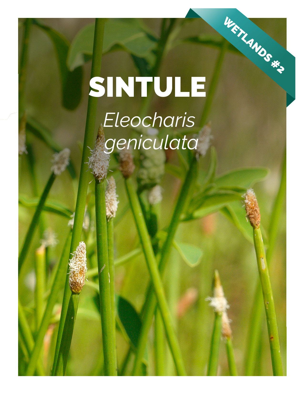
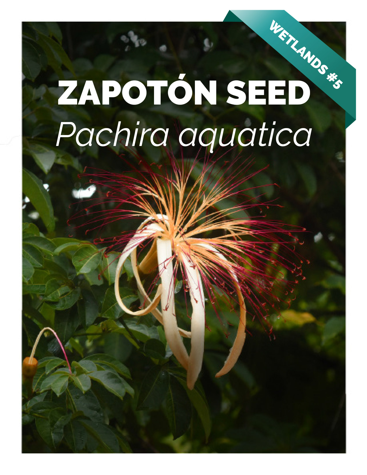
Plants of Municipio de Livingston, Izabal
- Acrostichum danaeifolium, giant leather ferns
- Bellucia Pentamera
- Bibliography on Grias cauliflora
- Bibliography on Licania platypus
- Bibliography on Mangle negro (Avicennia germinans) L.
- Bibliography on Montriacardia arborescens
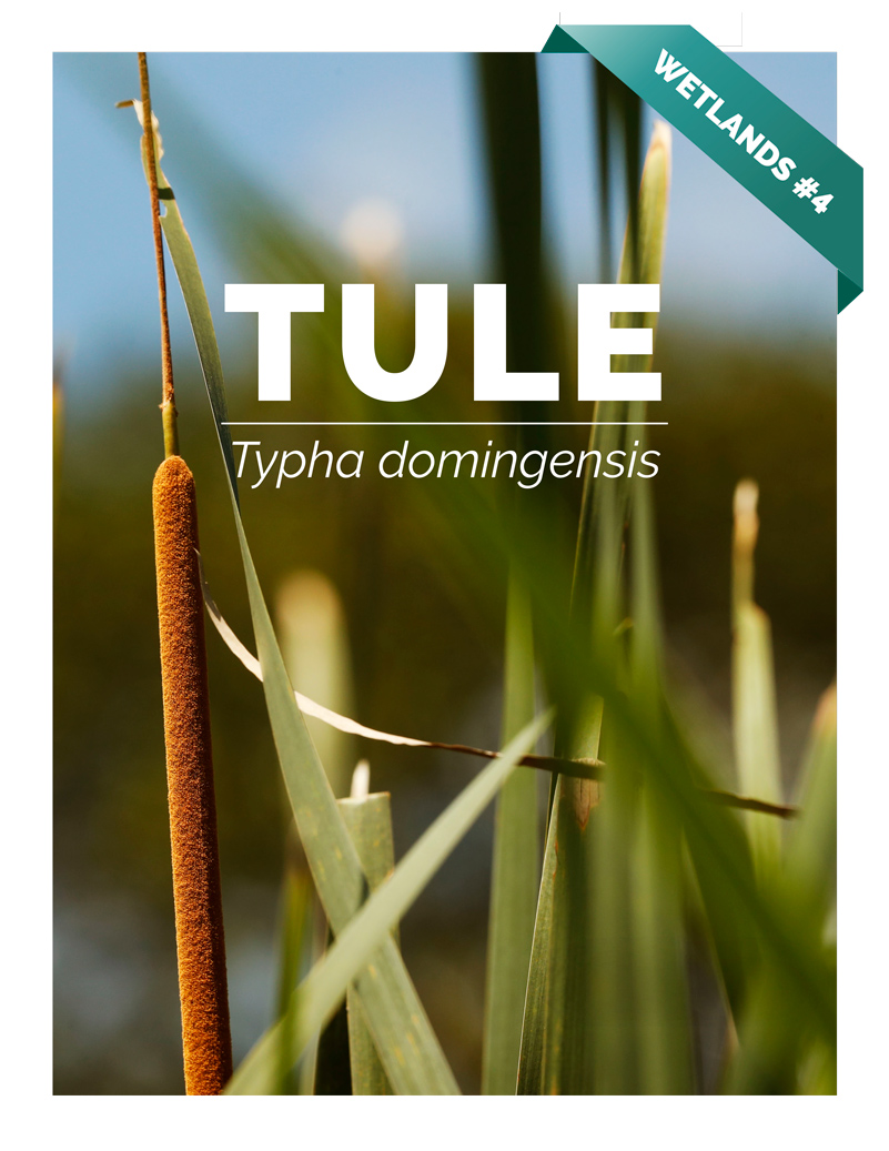
- Bibliography on Typha domingensis and Thypha latifolia
- Conocarpus erectus, white mangrove
- Edible Wetlands Plants, Hotel Tortugal
- Heliconia latispatha
- Heliconia wagneriana
- Manicaria saccifera Confra palm
- Neotropical trees of Guatemala need protection
- Nymphoides indica, waterlily flowers
- Pachira aquatica, zapoton
- Bibliography on Pithecellobium Mart., Neotropical trees of Mesoamerica
Ecosystems, Wetlands Aquatic Plants
Smartphone Camera Reviews
Bushes and small trees
Fungi and Lichens
Orchids
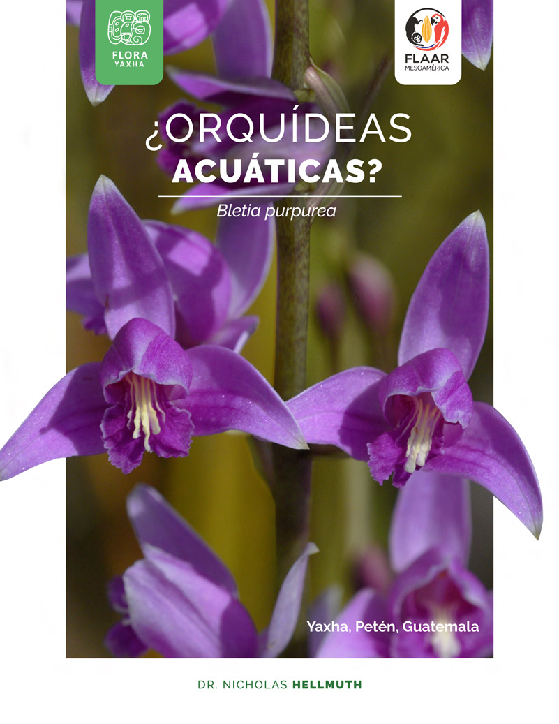
- Bibliography Bletia purpurea, aquatic orchid
- Bibliography, Epidendrum radicans
- Bibliography on Habenaria Orchids from Yaxha
- Bibliography, Lycaste virginalis var. alba.
- Bibliography, Macroclinium bicolor
- Bibliography, Prosthechea cochleata
- Bibliography Sobralia macrantha, Lirio de San Juan
- Bibliography, Sobralia xantholeuca
- Bibliography on Terrestrial shade orchids from Guatemala
- Bibliography on Terrestrial sunny orchids from Guatemala
Botanical Terms
Maya and Aztec flavorings for cacao, cocoa, chocolate
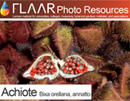
- Achiote, Bixa orellana
- Bibliography on Achiote, Bixa orellana
- Bibliography on Esquisúchil, Bourreria huanita
- Bourreria huanita
- Cassia grandis, bucut
- Chile Chocolate
- Chile Chocolate (Capsicum annuum var accuminatum)
- Chiranthodendron pentadactylon
- Cymbopetalum penduliflorum
- Guazuma ulmifolia
- Haematoxylum brasiletto
- Piper auritum, hoja santa
- Piper species
- Quararibea funebris
- Sterculia apetala, castaño
- Tagetes sp., Marigold
- Talauma, a variant of Magnolia
- Vanilla orchid
- Virola and nutmeg
Cacao, cocoa, chocolate
Consulting cacao & Theobroma species
Tobacco Ingredients of Aztec & Maya
Trees of Mesoamerica
- Bibliography on Acacia dolichostachya, Wild tamarind
- Bibliography, Bellucia costaricensis
- Bibliography, Bucida buceras
- Bibliography on Coccoloba belizensis Standl.
- Bibliography on Cojoba sp. and Cojoba arborea
- Bibliography, Ficus.
- Bibliography on Haematoxylum campechianum and H. brasiletto
- Bibliography on Hibiscus pernambucensis
- Bibliography on Ipomea murucoides
- Bibliography on Lacmellea standleyi, lechemiel
- Bibliography on Leucaena leucocephala
- Bibliography on mangle rojo (Rhizophora mangle)
- Bibliography on Manzanillo, Alseis yucatanensis Standl.
- Bibliography on Matilisguate, Tabebuia rosea
- Mangrove swamp Trees
- Bibliography on Ruagea insignis
- Bibliography on Pterocarpus officinalis
Bombacaceae, Bombacoideae
Tropical Fruits of the Maya
- Avocado Hass
- Bibliography on Coloc, Talisia floresii
- Bibliography, Dichogamy of avocado species
- Bibliography on Guayo, Talisia olivaeformis
- Bibliography on Laetia thamnia, Bakelac
- Bibliography on Maracuyá, Passiflora quadrangularis L.
- Bibliography on Punica granatum L., Granada
- Cashew
- Cuajilote, Parmentiera aculeata
- Granada
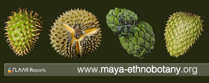
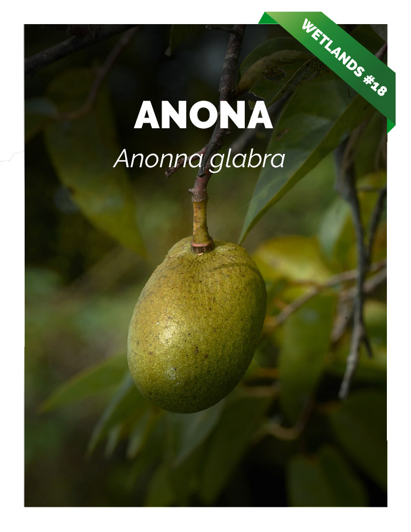
- Guanabas and Annonas
- Guava, Guayaba, Psidium guajava L
- Introduction to Papaya
- Nance a fruit of prehispanic Guatemala
- Passion flowers and fruits
- Passion flower, giant fruit
- Talisia floresii, Sapindaceae
- Carica Papaya Bibliography
Tropical Nuts
Spices, condiments, food coloring
Medicinal Plants
- Aristolochia, The largest flower in Guatemala, Bibliography
- Asclepias curassavica, bibliography
- Bibliography on Ciricote, Cordia dodecandra
- Bibliography on Contrahierba, Dorstenia contrajerva
- Bibliography on Falso hibisco, Malvaviscus arboreus
- Bibliography on Huele de noche, Cestrum nocturnum
- Bibliography on Lirio araña, Hymenocallis littoralis
- Bibliography on Roble Prieto, Ehretia tinifolia
- Bibliography, Tithonia diversifolia
- Canak
- Calliandra general info
- Guava, Guayaba
- Magnolia and Taluma
- Mayan medicinal plants
- Piper
- Tecomasuche, Coclospermum vitifolium
- Bibliography on Sufricay, Malmea depressa
- Bibliography on Wigandia urens
Underutilized edible plants
Edible Plants of the Mayan World
- Acacia, subin, bullhorn acacia
- Bibliography, Annona muricata
- Bibliography, Annona purpurea
- Bibliography, Annona reticulata
- Bibliography on Chipilín, Crotalaria longirostrata
- Bibliography on Chirimoya, Annona squamosa
- Bernoullia flammea
- Canna indica, tamale wrap
- Cuchamper, Gonolobus
- Guava, Guayaba
- Bibliography, Gonobolus sp.
- Bibliography, Parmentiera aculeata
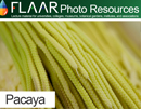
- Pacaya palm Chamaedorea tepejilote
- Split leaf philodendron, Monstera deliciosa
Plants and trees used to produce incense
Utilitarian Plants
- Bibliography, Acacia farnesiana
- Bibliography on Aechmea bromeliifolia
- Bibliography on Agave americana
- Bibliography, native Agave species from Guatemala
- Bibliography on Anthurium crassinervium (Jacq.) Schott
- Bibliography on Balsa, Ochroma pyramidale
- Bibliography on Bamboo, Guadua longifolia (E.Fourn) R.W.Pohl
- Bibliography, Crescentia alata
- Bibliography, Crescentia cujete
- Bibliography on Hule, Castilla elastica
- Blepharidium guatemalense, irayol blanco
- Crescentia alata, Crescentia cujete
- Tecomasuche, Coclospermum vitifolium
- Bibliography on Coxte, Colubrina arborescens
- Bibliography on Madre cacao, Gliricidia sepium
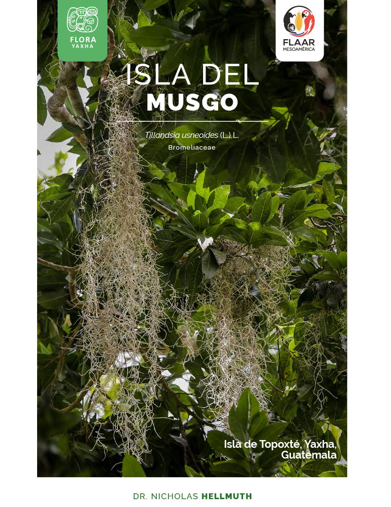
- Bibliography on Tillandsia usneoides
Flowers, edible
Camera Reviews for Photographing Flowers and Plants
Toxic plants
Trees with conical Spines
Flowers native to Guatemala visible now around the world

SUBJECTS TO BE COVERED DURING NEXT 6 MONTHS
Grains
Fruits (typical misnomer mishmash of Spanish language)
Other Fruits (primarily fruits from trees)
Fruits (vines or cacti)
Flavoring, herbs, and spices
Flowers, sacred
Plants which are sacred
Plants mentioned in myths
plants to produce Alcohol
Plants used for drugs
Plants or trees that are used to produce incense
Most common introduced plants (not native)
Glossaries
4x4 Pickup Truck Reviews, Evaluations and Suggestions

Visit other FLAAR sites |
||||||
|
FLAAR Mesoamerica |
MayanToons |
Nicholas Hellmuth |
||||
| |
||||||